Causeway, County Kerry
Village in Munster, Ireland
Causeway An Tóchar | |
|---|---|
Village | |
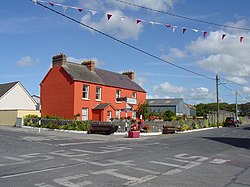 Crossroads at Causeway, County Kerry | |
| 52°24′52″N 09°43′59″W / 52.41444°N 9.73306°W / 52.41444; -9.73306 | |
| Country | Ireland |
| Province | Munster |
| County | County Kerry |
| Elevation | 22 m (72 ft) |
| Population (2022)[1] | 220 |
Causeway (Irish: an Tóchar / Ceann an Tóchar, historically anglicised as Kantogher)[2] is a village in County Kerry in Ireland. In the village there is one shop/post office, two hairdressers, a fast food outlet, a funeral home, a bakery and four pubs. Other amenities in the area include a GAA pitch, health centre, church, primary school, and a secondary school.[3]
Education
Causeway Comprehensive School is a co-educational school offering a complete second-level education to pupils from Kerryhead to Lisselton and from Ardfert to Dromclough.[4]
Geography
Causeway is approximately 16 miles (26 km) from Tralee on the R551 regional road. Causeway Parish is bordered to the south by Ardfert/Kilmoyley, to the west by Ballyheigue and to the northeast Ballyduff. To the north is the Shannon Estuary and the cliffs of Meenogahane.
History
"An Tóchar" is Irish for "(the) causeway".[2] The village was founded on an ancient Celtic roadway which originated in the neighbouring parish of Ballyheigue and was reputed to have ended in Tara, seat of the High-Kings of Ireland.[citation needed]
Shannonside Local Radio operated from Causeway from May, 1987 to May, 1988.[5]
According to 2022 census figures, the population of Causeway was 220, a decrease from the 257 inhabitants recorded in the 2016 census.[1]
See also
References
- ^ a b "Causeway". CSO.ie. Retrieved 16 June 2024.
- ^ a b "An Tóchar / Causeway (see archival records)". logainm.ie. Placenames Database of Ireland. Retrieved 25 December 2020.
- ^ "County Kerry Wastewater and Sludge Strategy" (PDF). Environmental Protection Agency, Ireland. Retrieved 28 October 2014.
- ^ "About Our School". Causeway Comprehensive School. Retrieved 28 October 2014.
- ^ "Shannonside Local Radio". Radiowaves Station Database. Retrieved 6 June 2024.
External links
- Causeway GAA
- v
- t
- e
Places in County Kerry
County town: Tralee
- Ballybunion
- Cahersiveen
- Castleisland
- Dingle
- Kenmare
- Killorglin
- Killarney
- Listowel
- Tralee

Villages and
Townlands
- Abbeydorney
- Annascaul
- Ardfert
- Asdee
- Ballydavid
- Ballinskelligs
- Ballyduff
- Ballyferriter
- Ballyheigue
- Ballylongford
- Ballymacelligott
- Ballyseedy
- Blennerville
- Bonane
- Brandon Creek
- Brandon
- Brosna
- Caherboshina
- Caherdaniel
- Camp
- Castlecove
- Castlegregory
- Castlemaine
- Causeway
- Chapeltown
- Cloghane
- Coolgarriv
- Currans
- Currow
- Derrymore
- Derrynane
- Duagh
- Dunquin
- Doonshean
- Fahamore
- Farranfore
- Fenit
- Feothanach
- Fieries
- Finuge
- Fossa
- Glenbeigh
- Glenflesk
- Gneeveguilla
- Kilcummin
- Kilderry
- Kilflynn
- Kilgarvan
- Kilmoyley
- Knightstown
- Knockanure
- Knocknagoshel
- Lispole
- Lisselton
- Lixnaw
- Milltown
- Moyvane
- Portmagee
- Rathmore
- Scraggane
- Sneem
- Spa
- Tarbert
- Templenoe
- Tuosist
- Valentia Island
- Ventry
- Waterville
- List of townlands in County Kerry
- Category:Geography of County Kerry
 | This article related to the geography of County Kerry, Ireland is a stub. You can help Wikipedia by expanding it. |
- v
- t
- e


 Causeway,_County_Kerry