Greenleaf, Wisconsin
Village in Wisconsin, United States
44°18′48″N 88°05′46″W / 44.31333°N 88.09611°W / 44.31333; -88.09611[1]
(2010)[2]
Greenleaf is a village in Brown County, Wisconsin, United States, in the town of Wrightstown.[3]
History
As of the 2010 census it had a population of 607.[4] Greenleaf was named for Emery B. Greenleaf, the general manager of the Milwaukee & Northern railroad at the time the Greenleaf post office was established in 1873.[5]
Incorporation as a Village
In 2020, 800 residents of the community petitioned the state of Wisconsin to become a village.[6] The Wisconsin Incorporation Review Board denied the petition's "characteristics of the territory" requirement as the petition included 2 separate areas: one in the vicinity of a roundabout of state highways WIS 57 and Wisconsin Highway 96 and another isolated area to the east of the Niagara Escarpment.[6] The second area is isolated from the first by the escarpment, a quarry and vacant lands.[6]
A revised proposal was approved on April 13, 2022.[7]
Geography
It is located at the intersection of Wisconsin Highways 57/32 and 96.[8] It uses ZIP code 54126.[9] Greenleaf has an area of 1.042 square miles (2.70 km2), all of it land. The community is part of the Green Bay Metropolitan Statistical Area.
References
- ^ "US Gazetteer files: 2010, 2000, and 1990". United States Census Bureau. February 12, 2011. Retrieved April 23, 2011.
- ^ "U.S. Census website". United States Census Bureau. Retrieved May 14, 2011.
- ^ a b "Greenleaf, Wisconsin". Geographic Names Information System. United States Geological Survey, United States Department of the Interior.
- ^ "Geographic Identifiers: 2010 Demographic Profile Data (G001): Greenleaf CDP, Wisconsin". U.S. Census Bureau, American Factfinder. Archived from the original on February 12, 2020. Retrieved May 13, 2014.
- ^ Callary, Edward (2016). Place Names of Wisconsin. Madison, WI: University of Wisconsin Press. p. 110. ISBN 978-0-299-30964-0.
- ^ a b c News, Brian Kerhin, FOX 11 (October 21, 2020). "Petition to create the village of Greenleaf denied". WLUK-TV. Retrieved January 24, 2021.
{{cite news}}:|last1=has generic name (help)CS1 maint: multiple names: authors list (link) CS1 maint: numeric names: authors list (link) - ^ "WI DOA Greenleaf Incorporation Determination" (PDF). wi.gov. Archived from the original (PDF) on May 15, 2022.
- ^ "Greenleaf, Wisconsin". Google Maps. Retrieved September 19, 2009.
- ^ United States Postal Service (2012). "USPS - Look Up a ZIP Code". Retrieved February 15, 2012.
Images
-
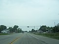 Looking north at the intersection of Wisconsin Highways 57/32 and 96 in Greenleaf
 -
 The sign for Greenleaf
 -
 Greenleaf Post office
 -
 Looking east at Greenleaf along WIS 96
 -
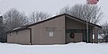
 Greenleaf Fire department


- v
- t
- e
Municipalities and communities of Brown County, Wisconsin, United States
County seat: Green Bay

- Dyckesville‡
- Greenleaf
communities
- Anston
- Askeaton
- Bay Settlement
- Benderville
- Buckman
- Champion
- Chapel Ridge
- Coppens Corner
- Edgewater Beach
- Fontenoy
- Glenmore
- Henrysville
- Hollandtown
- Kolb
- Kunesh
- Langes Corners
- Lark
- Little Rapids
- Mill Center
- Morrison
- New Franken
- Pine Grove
- Pittsfield‡
- Poland
- Red Banks
- Shirley
- Sniderville‡
- Sugar Bush
- Wayside
- Wequiock
neighborhoods
‡This populated place also has portions in an adjacent county or counties
- Wisconsin portal
- United States portal
 | This article about a location in Brown County, Wisconsin is a stub. You can help Wikipedia by expanding it. |
- v
- t
- e


