Hosrayel
Place in Keserwan-Jbeil, Lebanon
Hosrayel حصرايل Hisrail | |
|---|---|
| Nickname: Hisrayel | |
| 34°9′50″N 35°39′10″E / 34.16389°N 35.65278°E / 34.16389; 35.65278 | |
| Country | Lebanon |
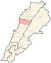
| Governorate | Keserwan-Jbeil |
| District | Byblos |
| Founded by | Chahine Family |
| Government | |
| Area | |
| • Total | 2.59 km2 (1.00 sq mi) |
| Elevation | 220 m (720 ft) |
Hosrayel (Arabic: حصرايل, also spelled Hisrail or Hasrayel) is a municipality in the Byblos District of Keserwan-Jbeil Governorate, Lebanon. It is 44 kilometers north of Beirut. Hosrayel has an average elevation of 220 meters above sea level and a total land area of 259 hectares.[1] Its inhabitants are predominantly Maronite Catholics.[2]
References
- v
- t
- e
 Byblos District, Keserwan-Jbeil Governorate
Capital: Byblos
- Aabaydat
- Almat el-Chmaliyeh
- Almat el-Jnoubiyeh
- Amsheet
- Annaya
- Aqoura
- Adonis
- Afqa
- Ain ed-Delbeh
- Ain el-Ghouaybeh
- Ain Jrain
- Ain Kfaa
- Bazyoun
- Bchilleh
- Beer el-Hit
- Behdidat
- Bejjeh
- Bekhaaz
- Berbara
- Beithabbak
- Bichtlida -Fidar
- Bentaël
- Birket Hjoula
- Blat
- Boulhos
- Brayj
- Byblos
- Chatine
- Chikhane
- Chmout
- Edde
- Ehmej
- Fatreh
- Ferhet
- Fidar
- Fghal
- Ghabat
- Ghalboun
- Gharzouz
- Ghorfine
- Habil
- Halat
- Haqel
- Hay el-Arabeh
- Hbaline
- Hboub
- Hdayneh
- Hjoula
- Hosrayel
- Hsarat
- Hsoun
- Jaj
- Janneh
- Jeddayel
- Jenjol
- Jlisseh
- Jouret el-Qattine
- Kafr
- Kfar Baal
- Kfar Hitta
- Kfar Kiddeh
- Kfar Masshoun
- Kfar Qouas
- Kfoun
- Laqlouq
- Lassa
- Lehfed
- Maad
- Majdel
- Marj
- Mastita
- Mayfouq
- Mazraat es-Siyad
- Mechane
- Mghayreh
- Mish Mish
- Mounsef
- Nahr Ibrahim
- Qahmez
- Qartaba
- Qartaboun
- Qorqraiya
- Ram
- Ras Osta
- Rihaneh
- Seraaita
- Souaneh
- Tartej
- Tourzaiya
- Yanouh
- Zebdine
- Abraham River
- Byblos Castle
- Jaj Cedar National Park
- Laqlouq skiing resort
- Royal necropolis of Byblos
- Temple of Baalat Gebal
- Temple of the Obelisks
 | This Lebanon location article is a stub. You can help Wikipedia by expanding it. |
- v
- t
- e


 Hosrayel