Khiara
Village in Beqaa Governorate, Lebanon
Khiara الخياره | |
|---|---|
Village | |
| 33°41′20″N 35°50′53″E / 33.68889°N 35.84806°E / 33.68889; 35.84806 | |
| Country |  Lebanon Lebanon |
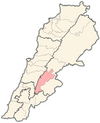
| Governorate | Beqaa Governorate |
| District | Western Beqaa District |
| Elevation | 2,850 ft (870 m) |
| Time zone | UTC+2 (EET) |
| • Summer (DST) | +3 |
Khiara (Arabic: الخياره), is a local authority located in the Western Beqaa District of the Beqaa Governorate in Lebanon.
History
In 1838, Eli Smith noted el-Khiyarah's population as being Sunni Muslim.[1]
References
- ^ Robinson and Smith, 1841, vol 3, 2nd appendix, p. 142
Bibliography
- Robinson, E.; Smith, E. (1841). Biblical Researches in Palestine, Mount Sinai and Arabia Petraea: A Journal of Travels in the year 1838. Vol. 3. Boston: Crocker & Brewster.
External links
- Khiara, localiban
- v
- t
- e
 Western Beqaa District, Beqaa Governorate
Capital: Joub Jannine
- Aammiq
- Aana
- Ain Zebdeh
- Aitanite
- Baaloul
- Bab Mareaa
- Baidar ech Chamout
- Dakoue
- Ghazzeh
- Haouch El Harimeh
- Kamid al lawz
- Kefraya
- Khiara
- Lala
- Libbaya
- Machghara
- Manara
- Marj
- Meidoun
- Qaraoun
- Qelaya
- Saghbine
- Sawiri
- Sohmor
- Sultan Yacoub
- Tell Zenoub
- Yohmor
- Zilaya
 | This Lebanon location article is a stub. You can help Wikipedia by expanding it. |
- v
- t
- e


 Khiara