Lesingey Round
50°7′7″N 5°33′50″W / 50.11861°N 5.56389°W / 50.11861; -5.56389
Scheduled monument
Lesingey Round is a ringfort, a smaller type of hillfort, about 1 mile (1.6 km) west of Penzance, in Cornwall, England. It is a scheduled monument.[1]
A 'round', the name for a ringfort in Cornwall where they are common, is a small circular embanked enclosure, with one entrance; they date from the late Iron Age to the early post-Roman period.[1]
Description
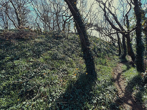
Lesingey Round is situated at the summit of a hill. The area of the site is wooded. The circular bank is 12–15 feet (3.7–4.6 m) above the partly buried external ditch and about 6 feet (1.8 m) above the interior; it encloses an area of about 1.5 acres (0.6 ha). As the inner slope of the rampart is absent in places, the location of the entrance is not known. There are no visible traces of occupation inside.[1][2]
In 1584 the topographer John Norden referred to an ancient ruined castle on a mound near Penzance, calling it Castle Horneck; he may have been describing this site, which suggests that the site was occupied in the medieval period. The existing Castle Horneck is about 400 metres (440 yd) away.[2]
Cornish 'Horn' and 'Hornek' are 'Iron' in English, so 'Castle Horneck' would have some kind of translation as 'Iron Castle'.
Lesingey Round is colloquially known as 'Bluebell Dell' and, although it is probably not technically a 'Dell' (in fact it is surprisingly elevated, and quite a step up so easily understood to be a fort) it is always full with bluebells each spring.
References
 Cornwall portal

- ^ a b c Historic England. "Round called Lesingey Round (1004400)". National Heritage List for England. Retrieved 2 April 2018.
- ^ a b Historic England. "Lesingey Round (423945)". Research records (formerly PastScape). Retrieved 2 April 2018.
- v
- t
- e
- Mowsbury Hill
- Maiden Bower
- Black Head
- Cadson Bury
- Caer Bran
- Castallack Round
- Castle an Dinas
- Castle Dore
- Castle Goff
- Chûn Castle
- Dodman Point
- Giant's Castle
- Kelly Rounds
- Kelsey Head
- Lescudjack
- Lesingey Round
- Maen Castle
- Padderbury Top
- Prideaux Castle
- Rame Head
- The Rumps
- Trencrom Hill
- Trereen Dinas
- Treryn Dinas
- Trevelgue Head
- Warbstow Bury
- Ashleys Copse
- Buckland Rings
- Bury Hill
- Caesar's Camp
- Castle Hill
- Chilworth Ring
- Danebury
- Dunwood Camp
- Frankenbury Camp
- The Frith
- Gorley Hill
- Hamble Common Camp
- King John's Hill
- Knoll Camp
- Ladle Hill
- Lockerley Camp
- Norsebury Ring
- Old Winchester Hill
- Oram's Arbour
- Quarley Hill
- St. Catherine's Hill
- Tidbury Ring
- Toothill Fort
- Whitsbury Castle
- Woolbury
- Bayston Hill
- Bury Ditches
- Bury Walls
- Caer Caradoc, Church Stretton
- Caer Caradog, Chapel Lawn
- Caus Castle
- Coxall Knoll
- Nordy Bank
- Old Oswestry
- The Wrekin
- Carl Wark
- Wincobank
- Ashleys Copse
- Barbury Castle
- Battlesbury Camp
- Bratton Castle
- Bury Camp
- Castle Ditches
- Casterley Camp
- Castle Rings
- Chisbury
- Chiselbury
- Chisenbury Camp
- Clearbury Ring
- Cley Hill
- Fosbury Camp
- Grovely Castle
- Knook Castle
- Liddington Castle
- Membury Camp
- Old Sarum
- Ringsbury Camp
- Roundway Down
- Scratchbury Camp
- Sidbury Hill
- Vespasian's Camp
- Winkelbury Camp
- Yarnbury Castle


