List of Historic Civil Engineering Landmarks
The following is a list of Historic Civil Engineering Landmarks as designated by the American Society of Civil Engineers since it began the program in 1964. The designation is granted to projects, structures, and sites in the United States (National Historic Civil Engineering Landmarks) and the rest of the world (International Historic Civil Engineering Landmarks). As of 2019, there are over 280 landmarks that have been approved by the ASCE Board of Direction.[1][2][3][4] Sections or chapters of the American Society of Civil Engineers may also designate state or local landmarks within their areas; those landmarks are not listed here.
| Ref# | Year designated | Name | Image | Built | Location Coordinates | Region/state | Country | Category |
|---|---|---|---|---|---|---|---|---|
| 1 | 1966 | Bollman Truss Bridge |  | 1869 | Savage 39°8′5.4″N 76°49′30.3″W / 39.134833°N 76.825083°W / 39.134833; -76.825083 (Bollman Truss Bridge) | Maryland | United States | bridges |
| 2 | 1967 | Bidwell Bar Bridge | 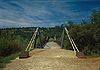 | 1856 | Oroville 39°32′14.8″N 121°27′15.6″W / 39.537444°N 121.454333°W / 39.537444; -121.454333 (Bidwell Bar Bridge) | California | United States | bridges |
| 3 | 1967 | Erie Canal |  | 1825 | Hudson River to Lake Erie 43°2′35.6″N 76°1′20.2″W / 43.043222°N 76.022278°W / 43.043222; -76.022278 (Erie Canal) | New York | United States | water transportation |
| 4 | 1967 | Middlesex Canal |  | 1803 | Middlesex County 42°30′21.4″N 71°9′25.8″W / 42.505944°N 71.157167°W / 42.505944; -71.157167 (Middlesex Canal) | Massachusetts | United States | water transportation |
| 5 | 1968 | Central Pacific Railroad | 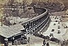 | 1863–1869 | Sacramento eastward 38°34′57″N 121°30′22.8″W / 38.58250°N 121.506333°W / 38.58250; -121.506333 (Central Pacific Railroad) | California | United States | roads & rails |
| 6 | 1968 | Durango-Silverton Branch of the D&RGW RR |  | 1882 | Durango 37°35′27.7″N 107°46′41.6″W / 37.591028°N 107.778222°W / 37.591028; -107.778222 (Durango-Silverton Branch of the D&RGW RR) | Colorado | United States | roads & rails |
| 7 | 1968 | Ellicott's Stone |  | 1799 | Mobile 30°59′52″N 88°1′21.1″W / 30.99778°N 88.022528°W / 30.99778; -88.022528 (Ellicott's Stone) | Alabama | United States | surveys & maps |
| 8 | 1968 | Acequias of San Antonio |  | 1718 | San Antonio 29°19′57.1″N 98°27′41.1″W / 29.332528°N 98.461417°W / 29.332528; -98.461417 (Acequias of San Antonio) | Texas | United States | water supply & control |
| 9 | 1968 | Joining of the Rails - Transcontinental Railroad | 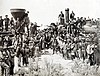 | 1869 | Promontory 41°37′4.7″N 112°33′5.8″W / 41.617972°N 112.551611°W / 41.617972; -112.551611 (Joining of the Rails - Transcontinental Railroad) | Utah | United States | roads & rails |
| 10 | 1968 | Wheeling Suspension Bridge | 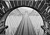 | 1849 | Wheeling 40°4′12.8″N 80°43′36.7″W / 40.070222°N 80.726861°W / 40.070222; -80.726861 (Wheeling Suspension Bridge) | West Virginia | United States | bridges |
| 11 | 1969 | Alvord Lake Bridge |  | 1889 | San Francisco 37°46′8.4″N 122°27′17.6″W / 37.769000°N 122.454889°W / 37.769000; -122.454889 (Alvord Lake Bridge) | California | United States | bridges |
| 12 | 1969 | Charleston - Hamburg Railroad |  | 1833 | Charleston to Hamburg 32°47′22.9″N 79°56′15.8″W / 32.789694°N 79.937722°W / 32.789694; -79.937722 (Charleston - Hamburg Railroad) | South Carolina | United States | roads & rails |
| 13 | 1970 | Ascutney Mill Dam |  | 1834 | Windsor 43°28′35″N 72°23′44.5″W / 43.47639°N 72.395694°W / 43.47639; -72.395694 (Ascutney Mill Dam) | Vermont | United States | dams |
| 14 | 1970 | Bridgeport Covered Bridge |  | 1862 | Nevada County 39°17′34.2″N 121°11′41.7″W / 39.292833°N 121.194917°W / 39.292833; -121.194917 (Bridgeport Covered Bridge) | California | United States | bridges |
| 15 | 1970 | Cornish–Windsor Covered Bridge |  | 1866, rebuilt 1988 | Windsor to Cornish 43°28′25.3″N 72°23′2.1″W / 43.473694°N 72.383917°W / 43.473694; -72.383917 (Cornish–Windsor Covered Bridge) | Vermont and New Hampshire | United States | bridges |
| 16 | 1970 | Frankford Avenue Bridge |  | 1697 | Philadelphia 40°2′36.7″N 75°1′14″W / 40.043528°N 75.02056°W / 40.043528; -75.02056 (Frankford Avenue Bridge) | Pennsylvania | United States | bridges |
| 17 | 1970 | Potowmack Canal and Locks |  | 1799 | Great Falls 38°59′25.3″N 77°14′58.1″W / 38.990361°N 77.249472°W / 38.990361; -77.249472 (Potowmack Canal and Locks) | Virginia | United States | water transportation |
| 18 | 1970 | Theodore Roosevelt Dam & Salt River Project |  | 1911 | 33°40′17.9″N 111°9′40.8″W / 33.671639°N 111.161333°W / 33.671639; -111.161333 (Theodore Roosevelt Dam & Salt River Project) | Arizona | United States | water supply & control |
| 19 | 1970 | Union Canal Tunnel | 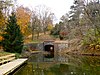 | 1828 | Lebanon 40°20′58.5″N 76°27′41″W / 40.349583°N 76.46139°W / 40.349583; -76.46139 (Union Canal Tunnel) | Pennsylvania | United States | water transportation |
| 20 | 1971 | Bethlehem Waterworks |  | 1761 | Bethlehem 40°37′8.7″N 75°22′58.2″W / 40.619083°N 75.382833°W / 40.619083; -75.382833 (Bethlehem Waterworks) | Pennsylvania | United States | water supply & control |
| 21 | 1971 | Druid Lake Dam |  | 1871 | Baltimore 39°19′7″N 76°37′53″W / 39.31861°N 76.63139°W / 39.31861; -76.63139 (Druid Lake Dam) | Maryland | United States | dams |
| 22 | 1971 | Eads Bridge |  | 1874 | St. Louis 38°37′44″N 90°10′43.3″W / 38.62889°N 90.178694°W / 38.62889; -90.178694 (Eads Bridge) | Missouri | United States | bridges |
| 23 | 1971 | First Owens River - Los Angeles Aqueduct | 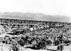 | 1913 | Owens Valley 36°58′32.4″N 118°12′38″W / 36.975667°N 118.21056°W / 36.975667; -118.21056 (First Owens River - Los Angeles Aqueduct) | California | United States | water supply & control |
| 24 | 1971 | Mormon Tabernacle | 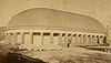 | 1867 | Salt Lake City 40°46′13.6″N 111°53′35.3″W / 40.770444°N 111.893139°W / 40.770444; -111.893139 (Mormon Tabernacle) | Utah | United States | buildings |
| 25 | 1972 | Cabin John Aqueduct |  | 1863 | Cabin John 38°58′22″N 77°8′54.9″W / 38.97278°N 77.148583°W / 38.97278; -77.148583 (Cabin John Aqueduct) | Maryland | United States | water supply & control |
| 26 | 1972 | Chesbroughs Water Supply System Chicago | 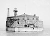 | 1869 | Chicago 41°53′49.8″N 87°37′27.9″W / 41.897167°N 87.624417°W / 41.897167; -87.624417 (Chesbroughs Water Supply System Chicago) | Illinois | United States | water supply & control |
| 27 | 1972 | Brooklyn Bridge | 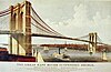 | 1883 | New York City 40°42′22″N 73°59′48.8″W / 40.70611°N 73.996889°W / 40.70611; -73.996889 (Brooklyn Bridge) | New York | United States | bridges |
| 28 | 1972 | Gunnison Tunnel |  | 1909 | Montrose 38°29′36″N 107°43′17″W / 38.49333°N 107.72139°W / 38.49333; -107.72139 (Gunnison Tunnel) | Colorado | United States | tunnels |
| 29 | 1972 | Roebling's Delaware Aqueduct of the Delaware & Hudson Canal |  | 1848, restored 1983 | Lackawaxen to Minisink Ford 41°28′57.5″N 74°59′4.1″W / 41.482639°N 74.984472°W / 41.482639; -74.984472 (Roebling's Delaware Aqueduct of the Delaware & Hudson Canal) | Pennsylvania & New York | United States | water transportation |
| 30 | 1972 | Miami Conservancy District |  | 1922 | near Dayton 39°45′49.2″N 84°11′29.2″W / 39.763667°N 84.191444°W / 39.763667; -84.191444 (Miami Conservancy District) | Ohio | United States | water supply & control |
| 31 | 1973 | Buffalo Bill Dam |  | 1910 | Cody 44°30′5.3″N 109°10′59.4″W / 44.501472°N 109.183167°W / 44.501472; -109.183167 (Buffalo Bill Dam) | Wyoming | United States | dams |
| 32 | 1973 | Cheesman Reservoir |  | 1905 | Southwest of Denver 39°12′27″N 105°16′20.1″W / 39.20750°N 105.272250°W / 39.20750; -105.272250 (Cheesman Reservoir) | Colorado | United States | dams |
| 33 | 1973 | Embudo Stream Gauging Station |  | 1889 | Embudo 36°12′18.4″N 105°57′49.2″W / 36.205111°N 105.963667°W / 36.205111; -105.963667 (Embudo Stream Gauging Station) | New Mexico | United States | water supply & control |
| 34 | 1973 | Ingalls Building |  | 1903 | Cincinnati 39°6′1″N 84°30′45.1″W / 39.10028°N 84.512528°W / 39.10028; -84.512528 (Ingalls Building) | Ohio | United States | buildings |
| 35 | 1973 | Pelton Impulse Water Wheel | 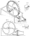 | 1878 | Camptonville 39°27′7″N 121°2′55″W / 39.45194°N 121.04861°W / 39.45194; -121.04861 (Pelton Impulse Water Wheel) | California | United States | power generation |
| 36 | 1973 | Starrucca Viaduct | 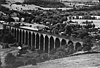 | 1848 | Lanesboro 41°57′51.3″N 75°35′0.6″W / 41.964250°N 75.583500°W / 41.964250; -75.583500 (Starrucca Viaduct) | Pennsylvania | United States | bridges |
| 37 | 1974 | Kansas City Park and Boulevard System |  | 1893 to 1915 | Kansas City 39°4′57″N 94°33′18″W / 39.08250°N 94.55500°W / 39.08250; -94.55500 (Kansas City Park and Boulevard System) | Missouri | United States | surveys & maps |
| 38 | 1974 | Milwaukee Metropolitan Sewage Treatment Plant, home of Milorganite[5] |  | 1919 | Milwaukee 43°1′21.3″N 87°53′57.3″W / 43.022583°N 87.899250°W / 43.022583; -87.899250 (Milwaukee Metropolitan Sewage Treatment Plant) | Wisconsin | United States | water supply & control |
| 39 | 1974 | Philadelphia Municipal Water Supply |  | 1801 | Philadelphia 39°57′56″N 75°10′51″W / 39.96556°N 75.18083°W / 39.96556; -75.18083 (Philadelphia Municipal Water Supply) | Pennsylvania | United States | water supply & control |
| 40 | 1974 | Stone Arch Bridge |  | 1883 | Minneapolis 44°58′50.8″N 93°15′12.3″W / 44.980778°N 93.253417°W / 44.980778; -93.253417 (Stone Arch Bridge) | Minnesota | United States | bridges |
| 41 | 1975 | Castillo de San Marcos |  | 1695 | St. Augustine 29°53′52″N 81°18′41″W / 29.89778°N 81.31139°W / 29.89778; -81.31139 (Castillo de San Marcos) | Florida | United States | buildings |
| 42 | 1975 | Croton Water Supply System |  | 1842 | New York City 41°0′42.5″N 73°52′36.4″W / 41.011806°N 73.876778°W / 41.011806; -73.876778 (Croton Water Supply System) | New York | United States | water supply & control |
| 43 | 1975 | Folsom Hydroelectric Power System |  | 1895 | Folsom 38°40′46.6″N 121°10′37.2″W / 38.679611°N 121.177000°W / 38.679611; -121.177000 (Folsom Hydroelectric Power System) | California | United States | power generation |
| 44 | 1975 | Granite Railway |  | 1826 | Quincy 42°14′44.6″N 71°2′9″W / 42.245722°N 71.03583°W / 42.245722; -71.03583 (Granite Railway) | Massachusetts | United States | roads & rails |
| 45 | 1975 | Hoosac Tunnel |  | 1875 | Berkshire County 42°40′31.1″N 73°2′45.1″W / 42.675306°N 73.045861°W / 42.675306; -73.045861 (Hoosac Tunnel) | Massachusetts | United States | tunnels |
| 46 | 1975 | Lawrence Experiment Station |  | 1886 | Lawrence 42°41′53.8″N 71°9′55.7″W / 42.698278°N 71.165472°W / 42.698278; -71.165472 (Lawrence Experiment Station) | Massachusetts | United States | research & educational |
| 47 | 1975 | Marlette Lake Water System |  | 1873 to 1887 | Virginia City 39°13′9.5″N 119°47′20.1″W / 39.219306°N 119.788917°W / 39.219306; -119.788917 (Marlette Lake Water System) | Nevada | United States | water supply & control |
| 48 | 1975 | Mount Washington Cog Railway |  | 1869 | Mount Washington 44°16′26″N 71°19′55″W / 44.27389°N 71.33194°W / 44.27389; -71.33194 (Mount Washington Cog Railway) | New Hampshire | United States | roads & rails |
| 49 | 1975 | Smithfield Street Bridge |  | 1883 | Pittsburgh 40°26′5.4″N 80°0′7.7″W / 40.434833°N 80.002139°W / 40.434833; -80.002139 (Smithfield Street Bridge) | Pennsylvania | United States | bridges |
| 50 | 1975 | Tunkhannock Viaduct |  | 1915 | Nicholson 41°37′34.2″N 75°46′34.4″W / 41.626167°N 75.776222°W / 41.626167; -75.776222 (Tunkhannock Viaduct) | Pennsylvania | United States | bridges |
| 51 | 1976 | Crozet's Blue Ridge Tunnel |  | 1858 | Waynesboro 38°2′3.1″N 78°51′28.4″W / 38.034194°N 78.857889°W / 38.034194; -78.857889 (Crozet's Blue Ridge Tunnel) | Virginia | United States | tunnels |
| 52 | 1976 | Cumbres and Toltec Scenic Railroad |  | 1880 | Chama to Antonito 36°59′42″N 106°17′51.1″W / 36.99500°N 106.297528°W / 36.99500; -106.297528 (Cumbres and Toltec Scenic Railroad) | New Mexico and Colorado | United States | roads & rails |
| 53 | 1976 | Elephant Butte Dam |  | 1916 | Truth or Consequences 33°9′14.9″N 107°11′31.3″W / 33.154139°N 107.192028°W / 33.154139; -107.192028 (Elephant Butte Dam) | New Mexico | United States | dams |
| 54 | 1976 | First Concrete Pavement |  | 1893 | Bellefontaine 40°21′37.5″N 83°45′33.6″W / 40.360417°N 83.759333°W / 40.360417; -83.759333 (First Concrete Pavement) | Ohio | United States | roads & rails |
| 55 | 1976 | International Boundary Marker No. 1[6] |  | 1855 | Doña Ana County 31°47′2″N 106°31′47.1″W / 31.78389°N 106.529750°W / 31.78389; -106.529750 (International Boundary Marker No. 1) | New Mexico | United States | surveys & maps |
| 56 | 1976 | King's Road |  | 1766 to 1775 | New Smyrna 29°38′23.4″N 81°16′50.3″W / 29.639833°N 81.280639°W / 29.639833; -81.280639 (King's Road) | Florida | United States | roads & rails |
| 57 | 1976 | National Road |  | 1811–1839 | Cumberland to Vandalia 39°57′38.7″N 82°27′2″W / 39.960750°N 82.45056°W / 39.960750; -82.45056 (National Road) | Maryland to Illinois | United States | roads & rails |
| 58 | 1977 | Charlestown Naval Dry Dock |  | 1833 | Boston 42°22′23.7″N 71°3′19.3″W / 42.373250°N 71.055361°W / 42.373250; -71.055361 (Charlestown Naval Dry Dock) | Massachusetts | United States | water transportation |
| 59 | 1977 | City Plan of Savannah |  | 1733 | Savannah 32°4′32″N 81°5′31″W / 32.07556°N 81.09194°W / 32.07556; -81.09194 (City Plan of Savannah) | Georgia | United States | surveys & maps |
| 60 | 1977 | Great Falls Raceway and Power System |  | 1800 | Paterson 40°54′55.1″N 74°10′52.1″W / 40.915306°N 74.181139°W / 40.915306; -74.181139 (Great Falls Raceway and Power System) | New Jersey | United States | power generation |
| 61 | 1977 | First New York Subway |  | 1904 | New York City 40°42′45.3″N 74°0′24.2″W / 40.712583°N 74.006722°W / 40.712583; -74.006722 (First New York Subway) | New York | United States | roads & rails |
| 62 | 1977 | Mason–Dixon line |  | 1767 | 39°43′16.1″N 80°7′5.3″W / 39.721139°N 80.118139°W / 39.721139; -80.118139 (Mason–Dixon line) | Maryland & Pennsylvania | United States | surveys & maps |
| 63 | 1977 | Minot's Ledge Lighthouse |  | 1860 | off Scituate 42°16′11″N 70°45′32.9″W / 42.26972°N 70.759139°W / 42.26972; -70.759139 (Minot's Ledge Lighthouse) | Massachusetts | United States | water transportation |
| 64 | 1977 | Mullan Road |  | 1862 | Walla Walla 46°46′8.3″N 118°12′22.6″W / 46.768972°N 118.206278°W / 46.768972; -118.206278 (Mullan Road) | Washington | United States | roads & rails |
| 65 | 1977 | Dry Dock No 1 Norfolk Naval Shipyard |  | 1833 | Portsmouth 36°49′14″N 76°17′35″W / 36.82056°N 76.29306°W / 36.82056; -76.29306 (Gosport Naval Dry Docks) | Virginia | United States | water transportation |
| 66 | 1977 | Reversal of the Chicago River |  | 1900 | Chicago 41°42′18″N 87°56′2″W / 41.70500°N 87.93389°W / 41.70500; -87.93389 (Reversal of the Chicago River) | Illinois | United States | water transportation |
| 67 | 1977 | Vulcan Street Plant |  | 1882 | Appleton 44°15′29.2″N 88°23′50.2″W / 44.258111°N 88.397278°W / 44.258111; -88.397278 (Vulcan Street Plant) | Wisconsin | United States | power generation |
| 68 | 1977 | William E. Ward House |  | 1876 | Rye Brook 41°1′32.5″N 73°40′3.1″W / 41.025694°N 73.667528°W / 41.025694; -73.667528 (William E. Ward House) | New York | United States | buildings |
| 69 | 1978 | Boston Subway |  | 1897 | Boston 42°21′23.8″N 71°3′43.6″W / 42.356611°N 71.062111°W / 42.356611; -71.062111 (Boston Subway) | Massachusetts | United States | roads & rails |
| 70 | 1978 | Dunlap's Creek Bridge |  | 1839 | Brownsville 40°1′17.2″N 79°53′17.2″W / 40.021444°N 79.888111°W / 40.021444; -79.888111 (Dunlap's Creek Bridge) | Pennsylvania | United States | bridges |
| 71 | 1978 | Hudson and Manhattan Railroad Tunnel |  | 1908 | Jersey City to New York City 40°43′56.7″N 74°1′11.6″W / 40.732417°N 74.019889°W / 40.732417; -74.019889 (Hudson and Manhattan Railroad Tunnel) | New Jersey & New York | United States | tunnels |
| 72 | 1978 | Newark International Airport |  | 1928 | Newark 40°41′22.2″N 74°10′28.2″W / 40.689500°N 74.174500°W / 40.689500; -74.174500 (Newark International Airport) | New Jersey | United States | aviation |
| 73 | 1978 | United States Military Academy |  | 1813 | West Point 41°23′34.8″N 73°57′28.8″W / 41.393000°N 73.958000°W / 41.393000; -73.958000 (United States Military Academy) | New York | United States | research & educational |
| 74 | 1979 | Cleveland Hopkins Airport | 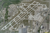 | 1925 | Cleveland 41°24′45″N 81°50′53″W / 41.41250°N 81.84806°W / 41.41250; -81.84806 (Cleveland Hopkins Airport) | Ohio | United States | aviation |
| 75 | 1979 | Fink Deck Truss Bridge |  | 1870 | Lynchburg 37°26′24.3″N 79°9′56″W / 37.440083°N 79.16556°W / 37.440083; -79.16556 (Fink Deck Truss Bridge) | Virginia | United States | bridges |
| 76 | 1979 | Fink Through Truss Bridge |  | 1858 | Hamden 40°36′14.3″N 74°54′8.1″W / 40.603972°N 74.902250°W / 40.603972; -74.902250 (Fink Through Truss Bridge) | New Jersey | United States | bridges |
| 77 | 1979 | Iron Bridge | 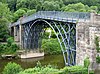 | 1779 | Ironbridge 52°37′38.4″N 2°29′7.6″W / 52.627333°N 2.485444°W / 52.627333; -2.485444 (Iron Bridge) | West Midlands | England | bridges |
| 78 | 1979 | Moffat Tunnel |  | 1928 | Winter Park 39°53′37.5″N 105°42′41.3″W / 39.893750°N 105.711472°W / 39.893750; -105.711472 (Moffat Tunnel) | Colorado | United States | tunnels |
| 79 | 1979 | Rockville Bridge |  | 1902 | Harrisburg 40°19′59.9″N 76°54′38.8″W / 40.333306°N 76.910778°W / 40.333306; -76.910778 (Rockville Bridge) | Pennsylvania | United States | bridges |
| 80 | 1980 | Goodyear Airdock |  | 1929 | Akron 41°1′54.9″N 81°28′14.6″W / 41.031917°N 81.470722°W / 41.031917; -81.470722 (Goodyear Airdock) | Ohio | United States | aviation |
| 81 | 1980 | Hydraulic-Inclined Plane System of the Morris Canal |  | 1831 | Waterloo Village 40°54′55.2″N 74°21′23.8″W / 40.915333°N 74.356611°W / 40.915333; -74.356611 (Hydraulic-Inclined Plane System of the Morris Canal) | New Jersey | United States | water transportation |
| 82 | 1981 | Borden Base Line |  | 1831 | Hatfield 42°25′33.7″N 72°37′9″W / 42.426028°N 72.61917°W / 42.426028; -72.61917 (Borden Base Line) | Massachusetts | United States | surveys & maps |
| 83 | 1981 | Chain of Rocks Water Purification Plant |  | 1904 | St. Louis 38°45′18.5″N 90°11′11.6″W / 38.755139°N 90.186556°W / 38.755139; -90.186556 (Chain of Rocks Water Purification Plant) | Missouri | United States | water supply & control |
| 84 | 1981 | Charles River Basin Project |  | 1910 | Boston 42°22′3.8″N 71°4′12.8″W / 42.367722°N 71.070222°W / 42.367722; -71.070222 (Charles River Basin Project) | Massachusetts | United States | water supply & control |
| 85 | 1981 | Cortland Street Drawbridge |  | 1902 | Chicago 41°55′1.1″N 87°39′51.4″W / 41.916972°N 87.664278°W / 41.916972; -87.664278 (Cortland Street Drawbridge) | Illinois | United States | bridges |
| 86 | 1981 | George Washington Bridge | 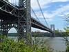 | 1931 | Fort Lee to New York City 40°51′6.1″N 73°57′9.7″W / 40.851694°N 73.952694°W / 40.851694; -73.952694 (George Washington Bridge) | New Jersey & New York | United States | bridges |
| 87 | 1981 | Louisville Water Works |  | 1875 to 1896 | Louisville 38°16′50″N 85°42′4.3″W / 38.28056°N 85.701194°W / 38.28056; -85.701194 (Louisville Water Works) | Kentucky | United States | water supply & control |
| 88 | 1981 | Montgomery Bell's Tunnel |  | 1818 | Cheatham County 36°8′48.5″N 87°7′19.3″W / 36.146806°N 87.122028°W / 36.146806; -87.122028 (Montgomery Bell's Tunnel) | Tennessee | United States | tunnels |
| 89 | 1981 | Snoqualmie Falls Cavity Generating Station |  | 1899 | Snoqualmie 47°32′39.5″N 121°50′29.3″W / 47.544306°N 121.841472°W / 47.544306; -121.841472 (Snoqualmie Falls Cavity Generating Station) | Washington | United States | power generation |
| 90 | 1981 | Union Station |  | 1894 | St. Louis 38°37′41.2″N 90°12′28.8″W / 38.628111°N 90.208000°W / 38.628111; -90.208000 (Union Station) | Missouri | United States | roads & rails |
| 91 | 1981 | Washington Monument | 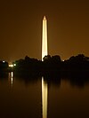 | 1885 | Washington 38°53′22.1″N 77°2′6.9″W / 38.889472°N 77.035250°W / 38.889472; -77.035250 (Washington Monument) | District of Columbia | United States | buildings |
| 92 | 1981 | Whipple Truss Bridge |  | 1855 | Schenectady 42°49′5.2″N 73°55′27″W / 42.818111°N 73.92417°W / 42.818111; -73.92417 (Whipple Truss Bridge) | New York | United States | bridges |
| 93 | 1982 | Carrollton Viaduct |  | 1829 | Baltimore 39°16′31.5″N 76°39′18″W / 39.275417°N 76.65500°W / 39.275417; -76.65500 (Carrollton Viaduct) | Maryland | United States | bridges |
| 94 | 1982 | Detroit-Windsor Tunnel |  | 1930 | Detroit 42°19′28″N 83°2′25.4″W / 42.32444°N 83.040389°W / 42.32444; -83.040389 (Detroit-Windsor Tunnel) | Michigan | United States | tunnels |
| 95 | 1982 | Eads South Pass Navigation Works |  | 1879 | Port Eads 28°59′50″N 89°8′38″W / 28.99722°N 89.14389°W / 28.99722; -89.14389 (Eads South Pass Navigation Works) | Louisiana | United States | water transportation |
| 96 | 1982 | Holland Tunnel | 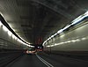 | 1927 | Jersey City to New York City 40°43′38.9″N 74°1′16″W / 40.727472°N 74.02111°W / 40.727472; -74.02111 (Holland Tunnel) | New Jersey & New York | United States | tunnels |
| 97 | 1982 | John A. Roebling Suspension Bridge |  | 1866 | Cincinnati 39°5′34.8″N 84°30′35.6″W / 39.093000°N 84.509889°W / 39.093000; -84.509889 (John A. Roebling Suspension Bridge) | Ohio | United States | bridges |
| 98 | 1982 | Kinzua Railway Viaduct |  | 1882 | McKean County 41°45′47.3″N 78°35′21.1″W / 41.763139°N 78.589194°W / 41.763139; -78.589194 (Kinzua Railway Viaduct) | Pennsylvania | United States | bridges |
| 99 | 1982 | Rogue River Bridge |  | 1931 | Gold Beach 42°25′40.5″N 124°24′47.5″W / 42.427917°N 124.413194°W / 42.427917; -124.413194 (Rogue River Bridge) | Oregon | United States | bridges |
| 100 | 1982 | Second Street Bridge |  | 1886 | Allegan 42°31′32.7″N 85°50′54.6″W / 42.525750°N 85.848500°W / 42.525750; -85.848500 (Second Street Bridge) | Michigan | United States | bridges |
| 101 | 1982 | Watertown Arsenal |  | 1859 | Watertown 42°21′44″N 71°9′58″W / 42.36222°N 71.16611°W / 42.36222; -71.16611 (Watertown Arsenal) | Massachusetts | United States | research & educational |
| 102 | 1983 | Atlantic City Convention Hall |  | 1929 | Atlantic City 39°21′18″N 74°26′19.1″W / 39.35500°N 74.438639°W / 39.35500; -74.438639 (Atlantic City Convention Hall) | New Jersey | United States | buildings |
| 103 | 1983 | Bailey Island Bridge |  | 1928 | Harpswell 43°44′57.1″N 69°59′19.3″W / 43.749194°N 69.988694°W / 43.749194; -69.988694 (Bailey Island Bridge) | Maine | United States | bridges |
| 104 | 1983 | Blenheim Bridge |  | 1855 | North Blenheim 42°28′18.4″N 74°26′29.4″W / 42.471778°N 74.441500°W / 42.471778; -74.441500 (Blenheim Bridge) | New York | United States | bridges |
| 105 | 1983 | Iron Building of the U.S. Army Arsenal |  | 1859 | Watervliet 42°43′5.9″N 73°42′14.5″W / 42.718306°N 73.704028°W / 42.718306; -73.704028 (Iron Building of the U.S. Army Arsenal) | New York | United States | buildings |
| 106 | 1983 | Ohio Canal System |  | 1848 | Akron 40°52′39.2″N 81°35′1.4″W / 40.877556°N 81.583722°W / 40.877556; -81.583722 (Ohio Canal System) | Ohio | United States | water transportation |
| 107 | 1983 | Peavey–Haglin Experimental Concrete Grain Elevator |  | 1900 | St. Louis Park 44°56′32.7″N 93°20′42.8″W / 44.942417°N 93.345222°W / 44.942417; -93.345222 (Peavey–Haglin Experimental Concrete Grain Elevator) | Minnesota | United States | buildings |
| 108 | 1983 | Sault Ste. Marie Hydroelectric Complex |  | 1902 | Sault Ste. Marie 46°29′50.8″N 84°19′55.7″W / 46.497444°N 84.332139°W / 46.497444; -84.332139 (Sault Ste. Marie Hydroelectric Complex) | Michigan | United States | power generation |
| 109 | 1983 | Zuiderzee Enclosure Dam | 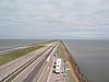 | 1927 to 1932 | Zaandam 52°59′37.5″N 5°9′19.1″E / 52.993750°N 5.155306°E / 52.993750; 5.155306 (Zuiderzee Enclosure Dam) | North Holland | Netherlands | water supply & control |
| 110 | 1984 | Columbia River Scenic Highway | 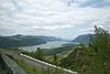 | 1922 | Portland 45°39′19.3″N 121°54′13.2″W / 45.655361°N 121.903667°W / 45.655361; -121.903667 (Columbia River Scenic Highway) | Oregon | United States | roads & rails |
| 111 | 1984 | Columbia-Wrightsville Bridge |  | 1930 | Columbia 40°1′42.4″N 76°31′5.6″W / 40.028444°N 76.518222°W / 40.028444; -76.518222 (Columbia-Wrightsville Bridge) | Pennsylvania | United States | bridges |
| 112 | 1984 | Golden Gate Bridge | 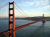 | 1937 | San Francisco 37°49′11.7″N 122°28′42.7″W / 37.819917°N 122.478528°W / 37.819917; -122.478528 (Golden Gate Bridge) | California | United States | bridges |
| 113 | 1984 | Hoover Dam |  | 1935 | Boulder City 36°0′57.7″N 114°44′14.8″W / 36.016028°N 114.737444°W / 36.016028; -114.737444 (Hoover Dam) | Nevada & Arizona | United States | dams |
| 114 | 1984 | Lowell Waterpower System |  | 1821 | Lowell 42°38′48.5″N 71°18′41.6″W / 42.646806°N 71.311556°W / 42.646806; -71.311556 (Lowell Waterpower System) | Massachusetts | United States | power generation |
| 115 | 1984 | Panama Canal |  | 1914 | Colón to Panama City9°7′2.2″N 79°43′7.6″W / 9.117278°N 79.718778°W / 9.117278; -79.718778 (Panama Canal) | Panama | water transportation | |
| 116 | 1984 | Rocky River Pumped Storage Hydro-Plant | 1925 | New Milford 41°34′49.7″N 73°26′13.2″W / 41.580472°N 73.437000°W / 41.580472; -73.437000 (Rocky River Pumped Storage Hydro-Plant) | Connecticut | United States | power generation | |
| 117 | 1985 | Bayonne Bridge |  | 1931 | Bayonne to Staten Island 40°38′29.8″N 74°8′31.6″W / 40.641611°N 74.142111°W / 40.641611; -74.142111 (Bayonne Bridge) | New Jersey & New York | United States | bridges |
| 118 | 1985 | Beginning Point of the U.S. Public Land Survey |  | 1785 | Liverpool 40°38′19.7″N 80°31′8.4″W / 40.638806°N 80.519000°W / 40.638806; -80.519000 (Beginning Point of the U.S. Public Land Survey) | Ohio | United States | surveys & maps |
| 119 | 1985 | Cape Cod Canal |  | 1914 | Barnstable County 41°45′51.1″N 70°34′6.3″W / 41.764194°N 70.568417°W / 41.764194; -70.568417 (Cape Cod Canal) | Massachusetts | United States | water transportation |
| 120 | 1985 | Chesapeake and Delaware Canal |  | 1828 (rebuilt 1927) | New Castle 39°32′34″N 75°43′14″W / 39.54278°N 75.72056°W / 39.54278; -75.72056 (Chesapeake and Delaware Canal) | Delaware | United States | water transportation |
| 121 | 1985 | Davis Island Lock and Dam | 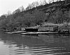 | 1885 | Pittsburgh 40°29′35″N 80°3′56″W / 40.49306°N 80.06556°W / 40.49306; -80.06556 (Davis Island Lock and Dam) | Pennsylvania | United States | water transportation |
| 122 | 1985 | Forth Railway Bridge |  | 1890 | North Queensferry to South Queensferry 56°0′1.5″N 3°23′19.4″W / 56.000417°N 3.388722°W / 56.000417; -3.388722 (Forth Railway Bridge) | Scotland | bridges | |
| 123 | 1985 | Going-to-the-Sun Road | 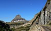 | 1932 | Glacier National Park 48°41′42″N 113°49′1.2″W / 48.69500°N 113.817000°W / 48.69500; -113.817000 (Going-to-the-Sun Road) | Montana | United States | roads & rails |
| 124 | 1985 | High Bridge |  | 1877 | Jessamine & Mercer Counties 37°49′1.7″N 84°43′12.4″W / 37.817139°N 84.720111°W / 37.817139; -84.720111 (High Bridge) | Kentucky | United States | bridges |
| 125 | 1985 | Statue of Liberty |  | 1886 | New York Harbor 40°41′21.5″N 74°2′40.4″W / 40.689306°N 74.044556°W / 40.689306; -74.044556 (Statue of Liberty) | New York[7] | United States | buildings |
| 126 | 1986 | White River Concrete Arch Bridge |  | 1930 | Cotter 36°16′2″N 92°32′39″W / 36.26722°N 92.54417°W / 36.26722; -92.54417 (White River Concrete Arch Bridge) | Arkansas | United States | bridges |
| 127 | 1986 | Cranetown Triangulation Site |  | 1817 | Cedar Grove 40°49′43.9″N 74°13′27.1″W / 40.828861°N 74.224194°W / 40.828861; -74.224194 (Cranetown Triangulation Site) | New Jersey | United States | surveys & maps |
| 128 | 1986 | Eiffel Tower | 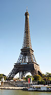 | 1889 | Paris 48°51′30.2″N 2°17′40.2″E / 48.858389°N 2.294500°E / 48.858389; 2.294500 (Eiffel Tower) | Île-de-France | France | buildings |
| 129 | 1986 | El Camino Real |  | 1598-1800s | Santa Fe and Mexico City 34°3′38.7″N 106°53′36.6″W / 34.060750°N 106.893500°W / 34.060750; -106.893500 (El Camino Real) | New Mexico | United States and Mexico | roads & rails |
| 130 | 1986 | El Camino Real (The Royal Road) Eastern Branch | 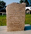 | from 16th century | San Antonio 29°26′45.8″N 98°30′12.3″W / 29.446056°N 98.503417°W / 29.446056; -98.503417 (El Camino Real (The Royal Road) Eastern Branch) | Texas | United States | roads & rails |
| 131 | 1986 | New Castle Ice Harbor |  | 1974 | New Castle 39°39′28″N 75°33′39″W / 39.65778°N 75.56083°W / 39.65778; -75.56083 (New Castle Ice Harbor) | Delaware | United States | water transportation |
| 132 | 1986 | Norris Dam | 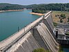 | 1936 | Knoxville 36°13′28″N 84°5′31.5″W / 36.22444°N 84.092083°W / 36.22444; -84.092083 (Norris Dam) | Tennessee | United States | dams |
| 133 | 1986 | San Francisco–Oakland Bay Bridge |  | 1937 | San Francisco to Oakland 37°47′53.6″N 122°22′40.7″W / 37.798222°N 122.377972°W / 37.798222; -122.377972 (San Francisco–Oakland Bay Bridge) | California | United States | bridges |
| 134 | 1986 | Sewall's Bridge |  | 1761 (rebuilt 1934) | York 43°8′10.2″N 70°39′38.3″W / 43.136167°N 70.660639°W / 43.136167; -70.660639 (Sewall's Bridge) | Maine | United States | bridges |
| 135 | 1986 | Triborough Bridge Project | 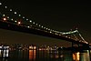 | 1936 | New York City 40°47′26.6″N 73°55′33.2″W / 40.790722°N 73.925889°W / 40.790722; -73.925889 (Triborough Bridge Project) | New York | United States | bridges |
| 136 | 1986 | U.S. Army Corps of Engineers Waterways Exp. Station |  | 1929 | Vicksburg 32°18′4.2″N 90°52′18″W / 32.301167°N 90.87167°W / 32.301167; -90.87167 (U.S. Army Corps of Engineers Waterways Exp. Station) | Mississippi | United States | research & educational |
| 137 | 1986 | U.S. Capitol |  | 1793, rebuilt 1863 | Washington 38°53′23″N 77°0′33″W / 38.88972°N 77.00917°W / 38.88972; -77.00917 (U.S. Capitol) | District of Columbia | United States | buildings |
| 138 | 1987 | Allegheny Portage Railroad |  | 1834 | Hollidaysburg 40°27′23″N 78°33′3.4″W / 40.45639°N 78.550944°W / 40.45639; -78.550944 (Allegheny Portage Railroad) | Pennsylvania | United States | roads & rails |
| 139 | 1987 | Bonneville Dam, Columbia River System |  | 1937 | Bonneville 45°38′39.7″N 121°56′26.7″W / 45.644361°N 121.940750°W / 45.644361; -121.940750 (Bonneville Dam, Columbia River System) | Oregon | United States | power generation |
| 140 | 1987 | Bridges of Keeseville |  | 1843, 1878, 1888 | Keeseville 44°30′13.2″N 73°28′57.3″W / 44.503667°N 73.482583°W / 44.503667; -73.482583 (Bridges of Keeseville) | New York | United States | bridges |
| 141 | 1987 | Dismal Swamp Canal |  | 1805 | Chesapeake to South Mills 36°35′34.1″N 76°23′5.4″W / 36.592806°N 76.384833°W / 36.592806; -76.384833 (Dismal Swamp Canal) | Virginia to North Carolina | United States | water transportation |
| 142 | 1987 | Houston Ship Channel |  | 1837–present | Houston 29°44′35.8″N 95°6′16.5″W / 29.743278°N 95.104583°W / 29.743278; -95.104583 (Houston Ship Channel) | Texas | United States | water transportation |
| 143 | 1987 | Kamehameha V Post Office | 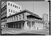 | 1871 | Honolulu 21°18′34.6″N 157°51′47.4″W / 21.309611°N 157.863167°W / 21.309611; -157.863167 (Kamehameha V Post Office) | Hawaii | United States | buildings |
| 144 | 1987 | Frisco Bridge |  | 1892 | Memphis 35°7′43.6″N 90°4′34.7″W / 35.128778°N 90.076306°W / 35.128778; -90.076306 (Frisco Bridge) | Tennessee & Arkansas | United States | bridges |
| 145 | 1987 | Quebec Bridge |  | 1917 | Quebec City 46°44′45.6″N 71°17′17.3″W / 46.746000°N 71.288139°W / 46.746000; -71.288139 (Quebec Bridge) | Quebec | Canada | bridges |
| 146 | 1988 | Belle Fourche Dam |  | 1911 | Belle Fourche 44°43′51.3″N 103°40′36.8″W / 44.730917°N 103.676889°W / 44.730917; -103.676889 (Belle Fourche Dam) | South Dakota | United States | dams |
| 147 | 1988 | École Nationale des Ponts et Chaussées |  | 1747 | Paris 48°51′20.9″N 2°19′49.9″E / 48.855806°N 2.330528°E / 48.855806; 2.330528 (École Nationale des Ponts et Chaussées) | Île-de-France | France | research & educational |
| 148 | 1988 | Keokuk Hydro-Power System |  | 1913 | Keokuk 40°23′56.6″N 91°21′49″W / 40.399056°N 91.36361°W / 40.399056; -91.36361 (Keokuk Hydro-Power System) | Iowa | United States | power generation |
| 149 | 1988 | Pennsylvania Turnpike |  | 1940 | 40°1′49.9″N 78°29′33.6″W / 40.030528°N 78.492667°W / 40.030528; -78.492667 (Pennsylvania Turnpike) | Pennsylvania | United States | roads & rails |
| 150 | 1988 | River des Peres Sewerage & Drainage Works |  | 1924 to 1931 | St. Louis 38°39′42.3″N 90°18′33.9″W / 38.661750°N 90.309417°W / 38.661750; -90.309417 (River des Peres Sewerage & Drainage Works) | Missouri | United States | water supply & control |
| 151 | 1988 | Sydney Harbour Bridge | 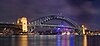 | 1932 | Sydney 33°51′8.1″S 151°12′38.6″E / 33.852250°S 151.210722°E / -33.852250; 151.210722 (Sydney Harbour Bridge) | New South Wales | Australia | bridges |
| 152 | 1989 | Royal Colonial Boundary of 1665 |  | 1728–1819 | Middlesboro 36°36′2.9″N 83°40′31.5″W / 36.600806°N 83.675417°W / 36.600806; -83.675417 (Royal Colonial Boundary of 1665) | Kentucky | United States | surveys & maps |
| 153 | 1989 | Zhaozhou Bridge |  | 605 AD | Zhaoxian 37°43′12.9″N 114°45′47.7″E / 37.720250°N 114.763250°E / 37.720250; 114.763250 (Zhaozhou Bridge) | Hebei | China | bridges |
| 154 | 1990 | Fort Peck Dam |  | 1940 | Fort Peck 48°0′10.1″N 106°24′58″W / 48.002806°N 106.41611°W / 48.002806; -106.41611 (Fort Peck Dam) | Montana | United States | dams |
| 155 | 1990 | Maria Pia Bridge |  | 1877 | Oporto 41°8′23.4″N 8°35′49.6″W / 41.139833°N 8.597111°W / 41.139833; -8.597111 (Maria Pia Bridge) | Norte | Portugal | bridges |
| 156 | 1990 | Salginatobel Bridge |  | 1930 | Grisons 46°58′54.4″N 9°43′5.1″E / 46.981778°N 9.718083°E / 46.981778; 9.718083 (Salginatobel Bridge) | Graubünden | Switzerland | bridges |
| 157 | 1991 | Eddystone Lighthouse |  | 1882 | off Plymouth 50°11′2″N 4°16′5.1″W / 50.18389°N 4.268083°W / 50.18389; -4.268083 (Eddystone Lighthouse) | England | water transportation | |
| 158 | 1991 | Fritz Engineering Laboratory | 1910 | Bethlehem 40°36′28.9″N 75°22′34.3″W / 40.608028°N 75.376194°W / 40.608028; -75.376194 (Fritz Engineering Laboratory) | Pennsylvania | United States | research & educational | |
| 159 | 1991 | St. Clair Tunnel |  | 1891 | Port Huron 42°57′32.4″N 82°25′22.2″W / 42.959000°N 82.422833°W / 42.959000; -82.422833 (St. Clair Tunnel) | Michigan | United States | tunnels |
| 160 | 1991 | Thames Tunnel |  | 1843 | London 51°30′12.7″N 0°3′13.3″W / 51.503528°N 0.053694°W / 51.503528; -0.053694 (Thames Tunnel) | England | tunnels | |
| 161 | 1992 | Acquedotto Traiano-Paolo |  | 110 AD | Rome 42°3′12.9″N 12°20′18.7″E / 42.053583°N 12.338528°E / 42.053583; 12.338528 (Acquedotto Traiano-Paolo) | Lazio | Italy | water supply & control |
| 162 | 1992 | Niagara Falls Suspension Bridge |  | 1849, 1855, 1883, 1898, 1941 | Niagara Gorge 43°5′24.8″N 79°4′3.4″W / 43.090222°N 79.067611°W / 43.090222; -79.067611 (Niagara Falls Suspension Bridge) | Ontario and New York | Canada and United States | bridges |
| 163 | 1992 | Duck Creek Aqueduct |  | 1846 | Metamora 39°26′46.1″N 85°7′48″W / 39.446139°N 85.13000°W / 39.446139; -85.13000 (Duck Creek Aqueduct) | Indiana | United States | water supply & control |
| 164 | 1992 | Hohokam Canal System |  | 600 - 1450 AD | Maricopa County 33°26′43.8″N 111°48′56.2″W / 33.445500°N 111.815611°W / 33.445500; -111.815611 (Hohokam Canal System) | Arizona | United States | water supply & control |
| 165 | 1992 | San Jacinto Monument |  | 1939 | Houston 29°44′59.5″N 95°4′50.6″W / 29.749861°N 95.080722°W / 29.749861; -95.080722 (San Jacinto Monument) | Texas | United States | buildings |
| 166 | 1993 | Blimp Hangars |  | 1942 | Tustin 33°42′10.8″N 117°49′26.3″W / 33.703000°N 117.823972°W / 33.703000; -117.823972 (Blimp Hangars) | California | United States | aviation |
| 167 | 1993 | Denison Dam |  | 1943 | Denison 33°49′52.6″N 96°34′16″W / 33.831278°N 96.57111°W / 33.831278; -96.57111 (Denison Dam) | Texas & Oklahoma | United States | dams |
| 168 | 1993 | Hanford B Reactor |  | 1944 | Richland 46°37′49.1″N 119°38′50.3″W / 46.630306°N 119.647306°W / 46.630306; -119.647306 (Hanford B Reactor) | Washington | United States | power generation |
| 169 | 1993 | Stevens Pass Railroad Tunnels & Switchback System |  | 1900 | Stevens Pass 47°44′52.4″N 121°7′26.3″W / 47.747889°N 121.123972°W / 47.747889; -121.123972 (Stevens Pass Railroad Tunnels & Switchback System) | Washington | United States | tunnels |
| 170 | 1994 | Colorado River Aqueduct |  | 1933–1941 | Blythe 34°17′23.6″N 114°10′19.5″W / 34.289889°N 114.172083°W / 34.289889; -114.172083 (Colorado River Aqueduct) | California | United States | water supply & control |
| 171 | 1994 | Kavanagh Building |  | 1936 | Buenos Aires 34°35′43.7″S 58°22′28.9″W / 34.595472°S 58.374694°W / -34.595472; -58.374694 (Kavanagh Building) | Argentina | buildings | |
| 172 | 1994 | Missouri River Bridges |  | 1926 | Chamberlain 43°48′42.1″N 99°20′16.1″W / 43.811694°N 99.337806°W / 43.811694; -99.337806 (Missouri River Bridges) | South Dakota | United States | bridges |
| 173 | 1995 | Red Hill Underground Fuel Storage Facility |  | 1943 | Honolulu 21°22′18″N 157°53′44″W / 21.37167°N 157.89556°W / 21.37167; -157.89556 (Red Hill Underground Fuel Storage Facility) | Hawaii | United States | tunnels |
| 174 | 1994 | Viaducto del Malleco |  | 1890 | Malleco River 37°57′47″S 72°26′20″W / 37.96306°S 72.43889°W / -37.96306; -72.43889 (Viaducto del Malleco) | Central Chile | Chile | bridges |
| 175 | 1994 | White Pass and Yukon Route |  | 1900 | Whitehorse, Yukon to Skagway, Alaska 59°37′28″N 135°8′18.3″W / 59.62444°N 135.138417°W / 59.62444; -135.138417 (White Pass and Yukon Route) | Yukon Territory to Alaska | Canada & United States | roads & rails |
| 176 | 1995 | Alaska Highway |  | 1942 | Dawson Creek to Delta Junction 59°54′39.6″N 131°33′20.6″W / 59.911000°N 131.555722°W / 59.911000; -131.555722 (Alaska Highway) | British Columbia to Alaska | Canada & United States | roads & rails |
| 177 | 1995 | Banaue Rice Terraces | 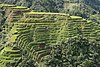 | 100 BC | Banaue 16°55′57.4″N 121°3′30.1″E / 16.932611°N 121.058361°E / 16.932611; 121.058361 (Banaue Rice Terraces) | Ifugao | Philippines | water supply & control |
| 178 | 1995 | Acueducto de Queretaro |  | 1738 | Querétaro 20°35′48″N 100°22′20.6″W / 20.59667°N 100.372389°W / 20.59667; -100.372389 (Acueducto de Queretaro) | Mexico | water supply & control | |
| 179 | 1995 | Victoria Falls Bridge | 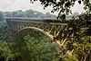 | 1905 | Zambezi River 17°55′41.7″S 25°51′26.1″E / 17.928250°S 25.857250°E / -17.928250; 25.857250 (Victoria Falls Bridge) | Zimbabwe & Zambia | bridges | |
| 180 | 1996 | Armour-Swift-Burlington Bridge |  | 1912 | Kansas City 39°7′0″N 94°34′47.5″W / 39.11667°N 94.579861°W / 39.11667; -94.579861 (Armour-Swift-Burlington Bridge) | Missouri | United States | bridges |
| 181 | 1996 | Dublin-Belfast railway line |  | 1839 | Dublin to Belfast 53°43′0″N 6°20′15″W / 53.71667°N 6.33750°W / 53.71667; -6.33750 (Dublin-Belfast railway line) | Ireland & Northern Ireland | roads & rails | |
| 182 | 1996 | Kentucky Dam |  | 1944 | Gilbertsville 37°0′46.4″N 88°16′10.1″W / 37.012889°N 88.269472°W / 37.012889; -88.269472 (Kentucky Dam) | Kentucky | United States | dams |
| 183 | 1996 | Lake Moeris Quarry Road | 2575-2137 BC | Lake Moeris 29°37′24.2″N 30°38′40.4″E / 29.623389°N 30.644556°E / 29.623389; 30.644556 (Lake Moeris Quarry Road) | Egypt | roads & rails | ||
| 184 | 1996 | City Plan of Philadelphia |  | 1682 | Philadelphia 39°57′28.6″N 75°10′14.2″W / 39.957944°N 75.170611°W / 39.957944; -75.170611 (City Plan of Philadelphia) | Pennsylvania | United States | surveys & maps |
| 185 | 1996 | San Antonio River Walk & Flood Control System | 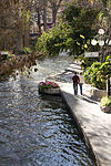 | 1929 to 1941 | San Antonio 29°25′30.7″N 98°29′29.7″W / 29.425194°N 98.491583°W / 29.425194; -98.491583 (San Antonio River Walk & Flood Control System) | Texas | United States | water control & supply |
| 186 | 1997 | Grand Coulee Dam |  | 1941 | Grand Coulee 47°57′23.8″N 118°58′51.6″W / 47.956611°N 118.981000°W / 47.956611; -118.981000 (Grand Coulee Dam) | Washington | United States | dams |
| 187 | 1997 | Lake Washington Ship Canal & Hiram M. Chittenden Locks |  | 1917 | Seattle 47°39′55.7″N 122°23′49.6″W / 47.665472°N 122.397111°W / 47.665472; -122.397111 (Lake Washington Ship Canal & Hiram M. Chittenden Locks) | Washington | United States | water transportation |
| 188 | 1997 | Navajo Bridge |  | 1929 | Page 36°49′3.4″N 111°37′52.3″W / 36.817611°N 111.631194°W / 36.817611; -111.631194 (Navajo Bridge) | Arizona | United States | bridges |
| 189 | 1997 | North Island Main Trunk Railway |  | 1885–1908 | Auckland to Wellington 39°13′39.8″S 175°23′55.5″E / 39.227722°S 175.398750°E / -39.227722; 175.398750 (North Island Main Trunk Railway) | North Island | New Zealand | roads & rails |
| 190 | 1997 | Northampton Street Bridge |  | 1896 | Easton to Phillipsburg 40°41′29.3″N 75°12′14.4″W / 40.691472°N 75.204000°W / 40.691472; -75.204000 (Northampton Street Bridge) | Pennsylvania & New Jersey | United States | bridges |
| 191 | 1997 | Snowy Mountains Scheme |  | 1974 | Snowy Mountains 35°36′40.1″S 148°17′29.8″E / 35.611139°S 148.291611°E / -35.611139; 148.291611 (Snowy Mountains Scheme) | New South Wales | Australia | power generation |
| 192 | 1997 | Texas Commerce Bank Building (formerly Gulf, now Chase) | 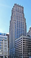 | 1929 | Houston 29°45′32″N 95°21′49.7″W / 29.75889°N 95.363806°W / 29.75889; -95.363806 (Texas Commerce Bank Building (formerly Gulf, now Chase)) | Texas | United States | buildings |
| 193 | 1997 | Walnut Street Bridge |  | 1890 | Harrisburg 40°15′27.1″N 76°53′9.8″W / 40.257528°N 76.886056°W / 40.257528; -76.886056 (Walnut Street Bridge) | Pennsylvania | United States | bridges |
| 194 | 1998 | Brooks AFB, Old Hangar 9 | 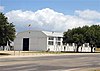 | 1918 | San Antonio 29°20′38.5″N 98°26′38.9″W / 29.344028°N 98.444139°W / 29.344028; -98.444139 (Brooks AFB, Old Hangar 9) | Texas | United States | aviation |
| 195 | 1998 | Canton Viaduct | 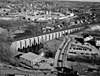 | 1835 | Canton 42°9′28.8″N 71°9′14.5″W / 42.158000°N 71.154028°W / 42.158000; -71.154028 (Canton Viaduct) | Massachusetts | United States | bridges |
| 196 | 1998 | Göta Canal | 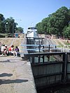 | 1810 to 1832 | Gothenburg 58°29′53.9″N 16°10′28.9″E / 58.498306°N 16.174694°E / 58.498306; 16.174694 (Göta Canal) | Västra Götaland | Sweden | water transportation |
| 197 | 1998 | Moseley Wrought Iron Arch Bridge |  | 1864 | North Andover 42°40′8.6″N 71°7′21.3″W / 42.669056°N 71.122583°W / 42.669056; -71.122583 (Moseley Wrought Iron Arch Bridge) | Massachusetts | United States | bridges |
| 198 | 1998 | Tehachapi Pass Railroad Line |  | 1876 | Kern County 35°12′3″N 118°32′13″W / 35.20083°N 118.53694°W / 35.20083; -118.53694 (Tehachapi Pass Railroad Line) | California | United States | roads & rails |
| 199 | 1999 | Acueducto de Segovia |  | 50 AD | Segovia 40°56′52.7″N 4°7′4.3″W / 40.947972°N 4.117861°W / 40.947972; -4.117861 (Acueducto de Segovia) | Castile and León | Spain | water supply & control |
| 200 | 1999 | Arroyo Seco Parkway |  | 1940 | Los Angeles 34°4′23″N 118°14′2″W / 34.07306°N 118.23389°W / 34.07306; -118.23389 (Arroyo Seco Parkway) | California | United States | roads & rails |
| 201 | 1999 | Blue Ridge Parkway |  | begun 1935 | Shenandoah NP to Great Smokey Mountains NP 36°26′28.5″N 81°5′42.9″W / 36.441250°N 81.095250°W / 36.441250; -81.095250 (Blue Ridge Parkway) | Virginia to North Carolina | United States | roads & rails |
| 202 | 1999 | Cape Hatteras Lighthouse | 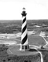 | 1870 | Cape Hatteras 35°15′2″N 75°31′43.7″W / 35.25056°N 75.528806°W / 35.25056; -75.528806 (Cape Hatteras Lighthouse) | North Carolina | United States | water transportation |
| 203 | 1999 | Maine Turnpike |  | 1947 | 43°21′17.2″N 70°35′26.2″W / 43.354778°N 70.590611°W / 43.354778; -70.590611 (Maine Turnpike) | Maine | United States | roads & rails |
| 204 | 1999 | McNeill Street Pumping Station |  | 1887 | Shreveport 32°31′3.8″N 93°45′25.9″W / 32.517722°N 93.757194°W / 32.517722; -93.757194 (McNeill Street Pumping Station) | Louisiana | United States | water supply & control |
| 205 | 2000 | Cedar Falls Hydroelectric Project | 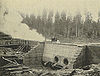 | 1901 | Seattle 47°25′9.2″N 121°46′54.4″W / 47.419222°N 121.781778°W / 47.419222; -121.781778 (Cedar Falls Hydroelectric Project) | Washington | United States | power generation |
| 206 | 2000 | Forth and Clyde Canal and Union Canal | 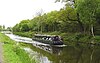 | 1790 | 55°56′18″N 4°9′18.8″W / 55.93833°N 4.155222°W / 55.93833; -4.155222 (Forth and Clyde Canal and Union Canal) | Scotland | water transportation | |
| 207 | 2000 | Hagia Sophia |  | 537 AD | Istanbul 41°0′31.2″N 28°58′48.6″E / 41.008667°N 28.980167°E / 41.008667; 28.980167 (Hagia Sophia) | Istanbul | Turkey | buildings |
| 208 | 2000 | Muskingum River Navigation System | 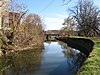 | 1837 | Zanesville 39°43′59.5″N 81°54′29.4″W / 39.733194°N 81.908167°W / 39.733194; -81.908167 (Muskingum River Navigation System) | Ohio | United States | water transportation |
| 209 | 2000 | Seventh Street Improvement Arches |  | 1909 | St. Paul 44°57′23″N 93°4′38″W / 44.95639°N 93.07722°W / 44.95639; -93.07722 (Seventh Street Improvement Arches) | Minnesota | United States | bridges |
| 210 | 2000 | West Baden Springs Hotel |  | 1902 | West Baden Springs 38°34′1.3″N 86°37′6.6″W / 38.567028°N 86.618500°W / 38.567028; -86.618500 (West Baden Springs Hotel) | Indiana | United States | buildings |
| 211 | 2001 | Bunker Hill Covered Bridge |  | 1895, rebuilt 1994 | Claremont 35°43′17.5″N 81°6′54.8″W / 35.721528°N 81.115222°W / 35.721528; -81.115222 (Bunker Hill Covered Bridge) | North Carolina | United States | bridges |
| 212 | 2001 | Galveston Seawall and Grade Raising | 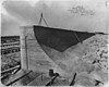 | 1904 (expanded through 1963) | Galveston 29°18′9″N 94°46′27″W / 29.30250°N 94.77417°W / 29.30250; -94.77417 (Galveston Seawall and Grade Raising) | Texas | United States | water supply & control |
| 213 | 2001 | Baltimore & Ohio Roundhouse & Shop Complex |  | 1842 to 1850s | Martinsburg 39°27′33″N 77°57′36″W / 39.45917°N 77.96000°W / 39.45917; -77.96000 (Baltimore & Ohio Roundhouse & Shop Complex) | West Virginia | United States | buildings |
| 214 | 2002 | Conwy Suspension Bridge |  | 1826 | Conwy 53°16′49.7″N 3°49′25.6″W / 53.280472°N 3.823778°W / 53.280472; -3.823778 (Conwy Suspension Bridge) | Conwy | Wales | bridges |
| 215 | 2002 | Conwy Tubular Bridge |  | 1849 | Conwy 53°16′49″N 3°49′25″W / 53.28028°N 3.82361°W / 53.28028; -3.82361 (Conwy Tubular Bridge) | Conwy | Wales | bridges |
| 216 | 2002 | Dorton Arena |  | 1952 | Raleigh 35°47′38.4″N 78°42′37.3″W / 35.794000°N 78.710361°W / 35.794000; -78.710361 (Dorton Arena) | North Carolina | United States | buildings |
| 217 | 2002 | East Maui Irrigation System |  | 1876 to 1923 | East Maui 20°52′0″N 156°13′0″W / 20.86667°N 156.21667°W / 20.86667; -156.21667 (East Maui Irrigation System) | Hawaii | United States | water supply & control |
| 218 | 2002 | Five Stone Arch Bridges |  | 1830 to 1866 | Hillsborough 43°7′49″N 71°56′41.1″W / 43.13028°N 71.944750°W / 43.13028; -71.944750 (Five Stone Arch Bridges) | New Hampshire | United States | bridges |
| 219 | 2002 | Louisville and Portland Canal Locks & Dam |  | 1830, rebuilt 1962 | Louisville 38°16′18.5″N 85°46′45.6″W / 38.271806°N 85.779333°W / 38.271806; -85.779333 (Louisville and Portland Canal Locks & Dam) | Kentucky | United States | water transportation |
| 220 | 2002 | Marshall Building | 1906 | Milwaukee 43°2′0.9″N 87°54′31.2″W / 43.033583°N 87.908667°W / 43.033583; -87.908667 (Marshall Building) | Wisconsin | United States | buildings | |
| 221 | 2002 | Menai Suspension Bridge | 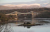 | 1826 | Anglesey 53°13′13.1″N 4°9′48.1″W / 53.220306°N 4.163361°W / 53.220306; -4.163361 (Menai Suspension Bridge) | Wales | bridges | |
| 222 | 2002 | Old Cape Henry Light, |  | 1792, replaced 1881 | Virginia Beach 36°55′32.8″N 76°0′29.3″W / 36.925778°N 76.008139°W / 36.925778; -76.008139 (Old Cape Henry Light) | Virginia | United States | water transportation |
| 223 | 2002 | Portland Head Light |  | 1787 | Cape Elizabeth 43°37′23.2″N 70°12′28.4″W / 43.623111°N 70.207889°W / 43.623111; -70.207889 (Portland Head Light) | Maine | United States | water transportation |
| 224 | 2002 | Shannon Hydroelectric Scheme |  | 1929 | 52°42′20″N 8°36′46″W / 52.70556°N 8.61278°W / 52.70556; -8.61278 (Shannon Hydroelectric Scheme) | Ireland | power generation | |
| 225 | 2002 | Waldo-Hancock Suspension Bridge |  | 1931 | Bucksport 44°33′37.6″N 68°48′5.9″W / 44.560444°N 68.801639°W / 44.560444; -68.801639 (Waldo-Hancock Suspension Bridge) | Maine | United States | bridges |
| 226 | 2003 | Horseshoe Curve | 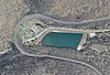 | 1854 | Altoona 40°29′54″N 78°29′9.1″W / 40.49833°N 78.485861°W / 40.49833; -78.485861 (Horseshoe Curve) | Pennsylvania | United States | roads & rails |
| 227 | 2003 | Suez Canal | 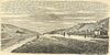 | 1869 | Port Said to Suez 30°42′18″N 32°20′39″E / 30.70500°N 32.34417°E / 30.70500; 32.34417 (Suez Canal) | Egypt | water transportation | |
| 228 | 2003 | Tennessee State Capitol | 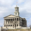 | 1845 to 1877 | Nashville 36°9′57.1″N 86°47′3.4″W / 36.165861°N 86.784278°W / 36.165861; -86.784278 (Tennessee State Capitol) | Tennessee | United States | buildings |
| 229 | 2004 | Hwaseong Fortress |  | 1796 | Suwon 37°17′0″N 127°0′57.6″E / 37.28333°N 127.016000°E / 37.28333; 127.016000 (Hwaseong Fortress) | Gyeonggi-do | Republic of Korea | buildings |
| 230 | 2004 | Mesa Verde Reservoirs |  | 750 to 1180 AD | Montezuma County 37°14′26.3″N 108°30′16.7″W / 37.240639°N 108.504639°W / 37.240639; -108.504639 (Mesa Verde Reservoirs) | Colorado | United States | water supply & control |
| 231 | 2004 | Northern Pacific High Line Bridge No 64 |  | 1908 | Valley City 46°56′18.9″N 97°59′26.9″W / 46.938583°N 97.990806°W / 46.938583; -97.990806 (Northern Pacific High Line Bridge No 64) | North Dakota | United States | bridges |
| 232 | 2004 | Old Wisla Bridge |  | Tczew 54°5′33.7″N 18°48′22.2″E / 54.092694°N 18.806167°E / 54.092694; 18.806167 (Old Wisla Bridge) | Vistula River | Poland | bridges | |
| 233 | 2005 | Great Western Railway |  | 1838 | 51°37′16.2″N 1°21′26.8″W / 51.621167°N 1.357444°W / 51.621167; -1.357444 (Great Western Railway) | England & Wales | roads & rails | |
| 234 | 2005 | Philadelphia City Hall |  | 1901 | Philadelphia 39°57′10.1″N 75°9′48.8″W / 39.952806°N 75.163556°W / 39.952806; -75.163556 (Philadelphia City Hall) | Pennsylvania | United States | buildings |
| 235 | 2005 | Sweetwater Dam |  | 1888 | Spring Valley 32°41′29.8″N 117°0′29.2″W / 32.691611°N 117.008111°W / 32.691611; -117.008111 (Sweetwater Dam) | California | United States | dams |
| 236 | 2005 | Stanley Hydraulics Laboratory at the University of Iowa |  | established 1919 | Iowa City 41°39′25.8″N 91°32′29″W / 41.657167°N 91.54139°W / 41.657167; -91.54139 (Stanley Hydraulics Laboratory at the University of Iowa) | Iowa | United States | research & educational |
| 237 | 2006 | Machu Picchu |  | 1460 AD | 13°9′48″S 72°32′44″W / 13.16333°S 72.54556°W / -13.16333; -72.54556 (Machu Picchu) | Peru | urban development | |
| 238 | 2006 | Portland Observatory |  | 1807 | Portland 43°39′55.4″N 70°14′53.7″W / 43.665389°N 70.248250°W / 43.665389; -70.248250 (Portland Observatory) | Maine | United States | water transportation |
| 239 | 2006 | Tipon |  | 1200 - 1534 AD | 13°34′15″S 71°46′59″W / 13.57083°S 71.78306°W / -13.57083; -71.78306 (Tipon) | Peru | water supply & control | |
| 240 | 2007 | Caledonian Canal |  | 1822 | Great Glen 57°6′44.9″N 4°44′18.8″W / 57.112472°N 4.738556°W / 57.112472; -4.738556 (Caledonian Canal) | Scotland | water transportation | |
| 241 | 2007 | Craigellachie Bridge Moray |  | 1814 | Strathspey 57°29′28.8″N 3°11′38″W / 57.491333°N 3.19389°W / 57.491333; -3.19389 (Craigellachie Bridge Moray) | Scotland | bridges | |
| 242 | 2008 | Choate Bridge |  | 1764 | Ipswich 42°40′46.1″N 70°50′13.6″W / 42.679472°N 70.837111°W / 42.679472; -70.837111 (Choate Bridge) | Massachusetts | United States | bridges |
| 243 | 2008 | Goldfields Water Supply |  | 1903 | Kalgoorlie 31°57′36″S 116°10′16.7″E / 31.96000°S 116.171306°E / -31.96000; 116.171306 (Goldfields Water Supply) | Western Australia | Australia | water supply & control |
| 244 | 2008 | Lacey V. Murrow Bridge and Mount Baker Ridge Tunnels |  | 1940 | King County 47°35′23.2″N 122°16′44.3″W / 47.589778°N 122.278972°W / 47.589778; -122.278972 (Lacey V. Murrow Bridge and Mount Baker Ridge Tunnels) | Washington | United States | bridges |
| 245 | 2008 | Woodhead Dam |  | 1897 | Cape Town 33°58′38.2″S 18°24′7.9″E / 33.977278°S 18.402194°E / -33.977278; 18.402194 (Woodhead Dam) | Western Cape | South Africa | dams |
| 246 | 2009 | Guayabo Ceremonial Center |  | 300 BC - AD 1400 | Turrialba 9°58′21.7″N 83°41′26.6″W / 9.972694°N 83.690722°W / 9.972694; -83.690722 (Guayabo Ceremonial Center) | Turrialba | Costa Rica | civil engineering profession |
| 247 | 2009 | Vancouver's Mapping of the West Coast of North America |  | 1791–1795 | 45°0′0″N 124°0′43″W / 45.00000°N 124.01194°W / 45.00000; -124.01194 (Vancouver's Mapping of the West Coast of North America) | Canada, Mexico and United States | surveys & maps | |
| 248 | 2009 | Poughkeepsie-Highland Bridge |  | 1886–1888 | Poughkeepsie 41°42′38.5″N 73°56′41.1″W / 41.710694°N 73.944750°W / 41.710694; -73.944750 (Poughkeepsie-Highland Bridge) | New York | United States | bridges |
| 249 | 2009 | Manhattan Bridge | 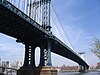 | 1909 | New York City 40°42′27″N 73°59′26.9″W / 40.70750°N 73.990806°W / 40.70750; -73.990806 (Manhattan Bridge) | New York | United States | bridges |
| 250 | 2009 | Queensboro Bridge | 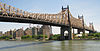 | 1909 | New York City 40°45′24.2″N 73°57′15.1″W / 40.756722°N 73.954194°W / 40.756722; -73.954194 (Queensboro Bridge) | New York | United States | bridges |
| 251 | 2009 | Williamsburg Bridge | 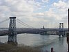 | 1903 | New York City 40°42′49.2″N 73°58′20.5″W / 40.713667°N 73.972361°W / 40.713667; -73.972361 (Williamsburg Bridge) | New York | United States | bridges |
| 252 | 2010 | Mackinac Bridge | 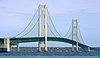 | 1958 | Straits of Mackinac 45°48′48.8″N 84°43′42″W / 45.813556°N 84.72833°W / 45.813556; -84.72833 (Mackinac Bridge) | Michigan | United States | bridges |
| 253 | 2010 | Rensselaer Polytechnic Institute | 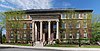 | 1824 | Troy 42°43′48″N 73°40′39″W / 42.73000°N 73.67750°W / 42.73000; -73.67750 (Rensselaer Polytechnic Institute) | New York | United States | research & educational |
| 254 | 2010 | Thomas Viaduct Railroad Bridge[8] |  | 1835 | Elkridge and Relay 39°13′17.5″N 76°42′48.1″W / 39.221528°N 76.713361°W / 39.221528; -76.713361 (Thomas Viaduct Railroad Bridge) | Maryland | United States | bridges |
| 255 | 2011 | Utica Memorial Auditorium | 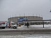 | 1959 | Utica 43°6′17.9″N 75°14′0.5″W / 43.104972°N 75.233472°W / 43.104972; -75.233472 (Utica Memorial Auditorium) | New York | United States | buildings |
| 256 | 2011 | Tacoma Narrows Bridges[9] |  | 1940-1950 | Tacoma 47°16′8″N 122°33′3″W / 47.26889°N 122.55083°W / 47.26889; -122.55083 (Tacoma Narrows Bridges) | Washington | United States | bridges |
| 257 | 2011 | Flight of Five Locks |  | 1915 | Waterford 42°48′2.8″N 73°41′29.1″W / 42.800778°N 73.691417°W / 42.800778; -73.691417 (Flight of Five Locks) | New York | United States | water transportation |
| 258 | 2011 | Petra |  | 309 BC | 30°19′43″N 35°26′31″E / 30.32861°N 35.44194°E / 30.32861; 35.44194 (Petra) | Ma'an Governorate | Jordan | buildings |
| 259 | 2012 | Zion-Mount Carmel Tunnel and Highway | 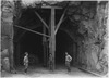 | 1930 | Zion National Park 37°12′40.7″N 112°57′29.6″W / 37.211306°N 112.958222°W / 37.211306; -112.958222 (Zion-Mount Carmel Tunnel and Highway) | Utah | United States | roads & rails |
| 260 | 2012 | Huey P. Long Bridge | 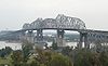 | 1935 | Jefferson Parish 29°56′38.8″N 90°10′7.6″W / 29.944111°N 90.168778°W / 29.944111; -90.168778 (Huey P. Long Bridge) | Louisiana | United States | bridges |
| 261 | 2012 | Grand Central Terminal |  | 1913 | New York City 40°45′10.3″N 73°58′37.9″W / 40.752861°N 73.977194°W / 40.752861; -73.977194 (Grand Central Terminal) | New York | United States | roads & rails |
| 262 | 2013 | Titan Clydebank crane |  | 1907 | Clydebank 55°53′50.5″N 4°24′31.2″W / 55.897361°N 4.408667°W / 55.897361; -4.408667 (Titan Clydebank crane) | West Dunbartonshire | Scotland | buildings |
| 263 | 2013 | Waterford Bridges |  | 1909 | Troy and Waterford 42°47′19.3″N 73°40′25.8″W / 42.788694°N 73.673833°W / 42.788694; -73.673833 (Waterford Bridges) | New York | United States | bridges |
| 264 | 2013 | Lake Pontchartrain Causeway |  | 1956 | Lake Pontchartrain 30°11′59.2″N 90°7′21.7″W / 30.199778°N 90.122694°W / 30.199778; -90.122694 (Lake Pontchartrain Causeway) | Louisiana | United States | bridges |
| 265 | 2014 | The Dalles Dam |  | 1957 | Columbia River 45°36′50.3″N 121°8′3″W / 45.613972°N 121.13417°W / 45.613972; -121.13417 (The Dalles Dam) | Oregon & Washington | United States | dams |
| 266 | 2015 | Gladesville Bridge |  | 1964 | Sydney 33°50′31.3″S 151°8′51.8″E / 33.842028°S 151.147722°E / -33.842028; 151.147722 (Gladesville Bridge) | New South Wales | Australia | bridges |
| 267 | 2016 | Cape Agulhas Lighthouse |  | 1848 | L'Agulhas 34°49′45.7″S 20°0′32.4″E / 34.829361°S 20.009000°E / -34.829361; 20.009000 (Cape Agulhas Lighthouse) | South Africa | water transportation | |
| 268 | 2016 | Arrowrock Dam |  | 1912 | Boise and Elmore 43°35′43″N 115°55′21.1″W / 43.59528°N 115.922528°W / 43.59528; -115.922528 (Arrowrock Dam) | Idaho | United States | dams |
| 269 | 2016 | All-American Canal[10] |  | 1940 | Imperial County 32°52′59″N 114°27′54″W / 32.88306°N 114.46500°W / 32.88306; -114.46500 (All-American Canal) | California | United States | water supply & control |
| 270 | 2016 | Canal du Midi[11] |  | 1681 | Toulouse to Étang de Thau 43°12′52.9″N 2°25′49.8″E / 43.214694°N 2.430500°E / 43.214694; 2.430500 (Canal du Midi) | Occitania | France | water transportation |
| 271 | 2016 | Liverpool and Manchester Railway[12] |  | 1830 | Liverpool to Manchester 53°27′10.8″N 2°36′58.6″W / 53.453000°N 2.616278°W / 53.453000; -2.616278 (Liverpool & Manchester Railway) | North West England | England | roads & rails |
| 272 | 2017 | Bonnet Carré Spillway |  | 1931 | St. Charles Parish 30°0′7.2″N 90°26′23.3″W / 30.002000°N 90.439806°W / 30.002000; -90.439806 (Bonnet Carré Spillway) | Louisiana | United States | dams |
| 273 | 2017 | Duluth Aerial Ferry/Lift Bridge[13] |  | 1905 | Duluth 46°46′45.8″N 92°5′35.3″W / 46.779389°N 92.093139°W / 46.779389; -92.093139 (Duluth Aerial Ferry/Lift Bridge) | Minnesota | United States | bridges |
| 274 | 2017 | Mississippi River Basin Model[14] |  | 1966 | Jackson 32°18′21.8″N 90°19′8.2″W / 32.306056°N 90.318944°W / 32.306056; -90.318944 (Mississippi River Basin Model) | Mississippi | United States | research & educational |
| 275 | 2017 | Chaffey Brothers Irrigation Works[15] |  | 1887 | Mildura and Renmark 34°15′1.6″S 142°13′28.8″E / 34.250444°S 142.224667°E / -34.250444; 142.224667 (Chaffey Brothers Irrigation Works) | Victoria and South Australia | Australia | water supply & control |
| 276 | 2017 | Qhapaq Ñan: The Great Inka Road System[16] |  | 1000 BC - 1533 AD | 13°13′0.3″S 72°23′5.2″W / 13.216750°S 72.384778°W / -13.216750; -72.384778 (Qhapaq Ñan: The Great Inka Road System) | Colombia to Chile | roads & rails | |
| 277 | 2017 | Tunnel of Eupalinos[17] |  | 520 BC | Samos 37°41′40.6″N 26°55′48″E / 37.694611°N 26.93000°E / 37.694611; 26.93000 (Tunnel of Eupalinos) | North Aegean | Greece | tunnels |
| 278 | 2018 | Augusta Canal and Industrial District |  | 1845 | Augusta 33°31′17.6″N 82°0′38.9″W / 33.521556°N 82.010806°W / 33.521556; -82.010806 (Augusta Canal and Industrial District) | Georgia | United States | power generation |
| 279 | 2018 | Old River Station[18] |  | 1907 | Cincinnati 39°4′17″N 84°25′40″W / 39.07139°N 84.42778°W / 39.07139; -84.42778 (Old River Station) | Ohio | United States | water supply & control |
| 280 | 2018 | Boundary Layer Wind Tunnel Laboratory[19] | 1965 | London 43°0′14″N 81°16′32.5″W / 43.00389°N 81.275694°W / 43.00389; -81.275694 (Boundary Layer Wind Tunnel Laboratory) | Ontario | Canada | research & educational | |
| 281 | 2018 | Institution of Civil Engineers[20] |  | 1818 | London 51°30′4″N 0°7′44.4″W / 51.50111°N 0.129000°W / 51.50111; -0.129000 (Institution of Civil Engineers) | England | research & educational | |
| 282 | 2018 | Union Chain Bridge[21] |  | 1820 | Horncliffe to Fishwick 55°45′9.3″N 2°6′24.4″W / 55.752583°N 2.106778°W / 55.752583; -2.106778 (Union Chain Bridge) | England to Scotland | bridges | |
| 283 | 2019 | Kaibab Trail Suspension Bridge[22] |  | 1928 | Grand Canyon 36°6′53.2″N 112°5′21.1″W / 36.114778°N 112.089194°W / 36.114778; -112.089194 (Kaibab Trail Suspension Bridge) | Arizona | United States | bridges |
| 284 | 2019 | Union Pacific Railroad[23] |  | 1868 | Omaha westward 41°15′0.9″N 95°55′37.4″W / 41.250250°N 95.927056°W / 41.250250; -95.927056 (Union Pacific Railroad) | Nebraska | United States | roads & rails |
| 285 | 2019 | Silver Bridge Collapse - Creation of National Inspection Standards[24] |  | 1967 | Point Pleasant 38°50′42″N 82°8′28″W / 38.84500°N 82.14111°W / 38.84500; -82.14111 (Silver Bridge Collapse - Creation of National Inspection Standards) | West Virginia | United States | bridges |
| 286 | 2020 | NASA Vehicle Assembly Building[25] |  | 1966 | Titusville 28°35′11″N 80°39′5″W / 28.58639°N 80.65139°W / 28.58639; -80.65139 (NASA Vehicle Assembly Building) | Florida | United States | buildings |
| 287 | 2021 | Main Avenue Bridge[26] |  | 1939 | Cleveland 41°29′55.2″N 81°42′18.5″W / 41.498667°N 81.705139°W / 41.498667; -81.705139 (Main Avenue Bridge) | Ohio | United States | bridges |
| 288 | 2021 | Sydney Opera House[15] | 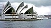 | 1973 | Sydney 33°51′24″S 151°12′55″E / 33.85667°S 151.21528°E / -33.85667; 151.21528 (Sydney Opera House) | New South Wales | Australia | buildings |
| 289 | 2022 | David Thompson's Surveying and Mapping of the Northwest of North America[27] |  | 1814 | Canada & United States | surveys & maps | ||
| 290 | 2022 | Portage Lake Bridge[28] |  | 1959 | Hancock and Houghton 47°7′25.9″N 88°34′26.7″W / 47.123861°N 88.574083°W / 47.123861; -88.574083 (Portage Lake Bridge) | Michigan | United States | bridges |
| 291 | 2022 | Salmon Creek Dam[29] |  | 1914 | Juneau 58°20′30″N 134°24′12″W / 58.34167°N 134.40333°W / 58.34167; -134.40333 (Salmon Creek Dam) | Alaska | United States | dams |
See also
References
- ^ Witcher, T.R. (January 2020). "Preserving the Profession's Achievements: The ASCE Historic Civil Engineering Landmark Program". Civil Engineering. American Society of Civil Engineers. p. 37.
- ^ "Historic Landmarks". American Society of Civil Engineers.
- ^ Grand Central Terminal is named a national historical civil engineering landmark
- ^ ASCE Names Huey P. Long Bridge a Civil Engineering Landmark Archived 2014-01-04 at the Wayback Machine
- ^ Stephens, Odin L.; Mengak, Michael T.; Osborn, David; Miller, Karl V. (March 2005). "Using Milorganite to temporarily repel white-tailed deer from food plots" (PDF). Wildlife Management Series. WSFR. Archived from the original (PDF) on 2012-03-29.
- ^ "International Boundary Marker | ASCE". www.asce.org. Retrieved 2017-10-20.
- ^ The Statue of Liberty is on Liberty Island, federal property administered by the National Park Service, located within the territorial jurisdiction of the State of New York. A pact between New York and New Jersey, ratified by Congress in 1834, declared this issue.
- ^ "Thomas Viaduct Railroad Bridge | ASCE". www.asce.org. Retrieved 2021-12-07.
- ^ "Tacoma Narrows Bridges | ASCE". www.asce.org. Retrieved 2021-12-07.
- ^ Harding, Matt (20 December 2016). "Canal System Now Engineering Landmark". Yuma Sun. p. 1.
- ^ "Canal du Midi Designated as International Historic Civil Engineering Landmark". American Academy of Water Resources Engineers. 2016-08-30. Retrieved 2022-08-20.
- ^ Morris, Paula (2016-09-14). "Rainhill reaffirmed as the birthplace of the railway". St Helens Star. Retrieved 2022-08-20.
- ^ Lundy, John (2017-09-11). "Centenarian engineer, Aerial Lift Bridge share honors". Duluth News Tribune. Retrieved 2022-08-20.
- ^ "In Military Lingo, MRBM = NHCEL". Preservation in Mississippi. 2018-05-24. Retrieved 2022-08-20.
- ^ a b "Sydney Opera House | ASCE". Retrieved 2022-08-10.
- ^ "Peru: Qhapaq Ñan designated ASCE historic civil engineering landmark". Andina. 2017-08-11. Retrieved 2022-08-20.
- ^ "Ανακήρυξη του Ευπαλίνειου Όρυγματος ως Ιστορικού Τοπόσημου Τεχνολογίας Πολιτικού Μηχανικού" [Designation of Tunnel of Eupalinos as a Historical Civil Engineering Landmark]. National Technical University of Athens School of Civil Engineering (in Greek). 2017-10-29. Retrieved 2022-08-20.
- ^ "Old River Station | Cincinnati Section ASCE". Retrieved 2022-08-10.
- ^ "Boundary Layer Wind Tunnel, London, Ontario". Canadian Society for Civil Engineering. Retrieved 2020-08-20.
- ^ Booth, Kenneth (2018-10-29). "ASCE recognises ICE as historic civil engineering landmark". Building Design & Construction. Retrieved 2022-08-20.
- ^ Johnson, Phil (2020-07-25). "Union Chain Bridge gets international badge of honour to mark bicentenary". The Scotsman. Retrieved 2022-08-20.
- ^ "Kaibab Trail Suspension Bridge | ASCE AZ Section". Retrieved 2022-08-10.
- ^ "Union Pacific Railroad | csengineermag.com". Retrieved 2022-08-10.
- ^ "Silver Bridge Collapse - Creation of National Inspection Standards | HMdb.org". Retrieved 2022-08-10.
- ^ "NASA Vehicle Assembly Building | NASA". Retrieved 2022-08-10.
- ^ "Main Avenue Bridge | ASCE Sections". Retrieved 2022-08-10.
- ^ Gilbert, David R.; Bartlett, F. Michael; Bedford, Cole G. (2022). David Thompson's Surveying and Mapping of the Northwest of North America. CSCE Annual Conference. Whistler, British Columbia.
- ^ "Portage Lake Bridge | MTU". www.mtu.edu/news. Retrieved 2022-08-10.
- ^ Kuhn, Jonson (2022-09-10). "Salmon Creek Dam recognized as a National Historic Civil Engineering Landmark". Juneau Empire. Retrieved 2022-09-13.
External links
- American Society of Civil Engineers Historic Landmarks
 Media related to Historic Civil Engineering Landmarks at Wikimedia Commons
Map all coordinates using OpenStreetMap
Download coordinates as:
- KML
- GPX (all coordinates)
- GPX (primary coordinates)
- GPX (secondary coordinates)


 List_of_Historic_Civil_Engineering_Landmarks