Manhay
Municipality in French Community, Belgium
Manhay Manhé (Walloon) | |
|---|---|
Municipality | |
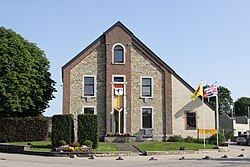 Manhay town hall | |
 Flag  Coat of arms | |
Location of Manhay  | |
  Manhay Location in Belgium Location of Manhay in Luxembourg province  | |
| Coordinates: 50°18′N 05°40′E / 50.300°N 5.667°E / 50.300; 5.667 | |
| Country |  Belgium Belgium |
| Community | French Community |
| Region | Wallonia |
| Province | Luxembourg |
| Arrondissement | Marche-en-Famenne |
| Government | |
| • Mayor | Geoffrey Huet |
| • Governing party/ies | AvecVousManhay |
| Area | |
| • Total | 120.18 km2 (46.40 sq mi) |
| Population (2018-01-01)[1] | |
| • Total | 3,463 |
| • Density | 29/km2 (75/sq mi) |
| Postal codes | 6960 |
| NIS code | 83055 |
| Area codes | 086 |
| Website | (in French) manhay.be |
Manhay (French pronunciation: [manɛ]; Walloon: Manhé) is a municipality of Wallonia located in the province of Luxembourg, Belgium.
On 1 January 2007 the municipality, which covers 119.81 km², had 3,185 inhabitants, giving a population density of 26.6 inhabitants per km².
The municipality consists of the following districts: Dochamps, Grandménil, Harre, Malempré, Odeigne and Vaux-Chavanne (town centre).
See also
References
- ^ "Wettelijke Bevolking per gemeente op 1 januari 2018". Statbel. Retrieved 9 March 2019.
External links
 Media related to Manhay at Wikimedia Commons
- v
- t
- e
Places adjacent to Manhay
| Durbuy | Ferrières (WLG) | Stoumont (WLG) |
 | ||
| Érezée |  Manhay Manhay | Lierneux (WLG) Vielsalm |
 | ||
| Rendeux | La Roche-en-Ardenne | Houffalize |
Municipalities of the province of Luxembourg, Wallonia | ||
|---|---|---|
| Arlon |  | |
| Bastogne | ||
| Marche-en-Famenne | ||
| Neufchâteau | ||
| Virton | ||
Bold indicates cities | ||
Authority control databases | |
|---|---|
| International |
|
| National |
|
| Geographic |
|
 | This Belgian Luxembourg location article is a stub. You can help Wikipedia by expanding it. |
- v
- t
- e


