Nitrianske Hrnčiarovce
Municipality in Nitra Region, Slovakia
Nitrianske Hrnčiarovce Nyitragerencsér | |
|---|---|
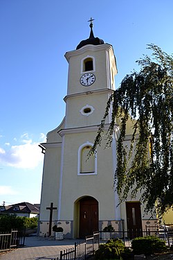 Church of Saint George | |
48°20′N 18°08′E / 48.33°N 18.13°E / 48.33; 18.13 | |
| Country |  Slovakia Slovakia |
| Region |  Nitra Region Nitra Region |
| District | Nitra District |
| First mentioned | 1113 |
| Area [1] | |
| • Total | 9.95 km2 (3.84 sq mi) |
| Elevation [2] | 204 m (669 ft) |
| Population (2021)[3] | |
| • Total | 2,393 |
| Time zone | UTC+1 (CET) |
| • Summer (DST) | UTC+2 (CEST) |
| Postal code | 951 01[2] |
| Area code | +421 37[2] |
| Car plate | NR |
| Website | www |
Nitrianske Hrnčiarovce (Slovak: [ˈɲitrɪɐnske ˈɦr̩ntʂɪɐrɔwtse]; Hungarian: Nyitragerencsér) is a village and municipality in the Nitra District in western central Slovakia, in the Nitra Region.[4]
History
In historical records the village was first mentioned in 1113.
Geography
The village lies at an altitude of 215 metres and covers an area of 9.946 km². It has a population of about 1820 people.
Ethnicity
The village is approximately 79% Slovak and 14% Hungarian according to 2021 census results.
Facilities
The village has a public library and a football pitch.
References
- ^ "Hustota obyvateľstva - obce [om7014rr_ukaz: Rozloha (Štvorcový meter)]". www.statistics.sk (in Slovak). Statistical Office of the Slovak Republic. 2022-03-31. Retrieved 2022-03-31.
- ^ a b c "Základná charakteristika". www.statistics.sk (in Slovak). Statistical Office of the Slovak Republic. 2015-04-17. Retrieved 2022-03-31.
- ^ "Počet obyvateľov podľa pohlavia - obce (ročne)". www.statistics.sk (in Slovak). Statistical Office of the Slovak Republic. 2022-03-31. Retrieved 2022-03-31.
- ^ "Nitrianske Hrnčiarovce - Okres Nitra - E-OBCE.sk".
External links
- Official website
- http://www.statistics.sk/mosmis/eng/run.html
- v
- t
- e
Municipalities of Nitra District
- Nitra
- Vráble
- Alekšince
- Báb
- Babindol
- Bádice
- Branč
- Cabaj-Čápor
- Čab
- Čakajovce
- Čechynce
- Čeľadice
- Čifáre
- Dolné Lefantovce
- Dolné Obdokovce
- Golianovo
- Horné Lefantovce
- Hosťová
- Hruboňovo
- Ivanka pri Nitre
- Jarok
- Jelenec
- Jelšovce
- Kapince
- Klasov
- Kolíňany
- Lehota
- Lúčnica nad Žitavou
- Lukáčovce
- Lužianky
- Ľudovítová
- Malé Chyndice
- Malé Zálužie
- Malý Cetín
- Malý Lapáš
- Melek
- Mojmírovce
- Nitrianske Hrnčiarovce
- Nová Ves nad Žitavou
- Nové Sady
- Paňa
- Podhorany
- Pohranice
- Poľný Kesov
- Rišňovce
- Rumanová
- Svätoplukovo
- Štefanovičová
- Štitáre
- Šurianky
- Tajná
- Telince
- Veľká Dolina
- Veľké Chyndice
- Veľké Zálužie
- Veľký Cetín
- Veľký Lapáš
- Vinodol
- Výčapy-Opatovce
- Zbehy
- Žirany
- Žitavce

| Authority control databases: National |
|
|---|
 | This Nitra Region geography article is a stub. You can help Wikipedia by expanding it. |
- v
- t
- e


 Nitrianske_Hrnčiarovce