Pirojpur Sadar Upazila
Upazila in Barisal, Bangladesh
Pirojpur Sadar পিরোজপুর সদর | |
|---|---|
Upazila | |
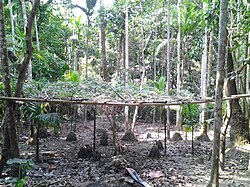 Forest in Kalakhali | |
 | |
| Coordinates: 22°34.7′N 89°59.4′E / 22.5783°N 89.9900°E / 22.5783; 89.9900 | |
| Country |  Bangladesh Bangladesh |
| Division | Barisal |
| District | Pirojpur |
| Headquarters | Pirojpur |
| Area | |
| • Total | 166.81 km2 (64.41 sq mi) |
| Population (2011) | |
| • Total | 163,470 |
| • Density | 980/km2 (2,500/sq mi) |
| Time zone | UTC+6 (BST) |
| Website | Official Map of the Pirojpur Sadar Upazila |
Pirojpur Sadar (Bengali: পিরোজপুর সদর) is an upazila of Pirojpur District in the Division of Barisal, Bangladesh.[1]
Geography
Pirojpur Sadar is located at 22°34′40″N 89°59′24″E / 22.5778°N 89.9900°E / 22.5778; 89.9900. It has a total area of 166.81 km2.
Demographics
| Religions in Pirojpur Sadar upazila (2011)[2] | ||||
|---|---|---|---|---|
| Religion | Percent | |||
| Islam | 83.44% | |||
| Hinduism | 16.51% | |||
| Other or not stated | 0.05% | |||
According to the 2011 Bangladesh census, Pirojpur Sadar Upazila had 38,017 households and a population of 163,470. 34,704 (21.23%) were under 10 years of age. Pirojpur Sadar had a literacy rate (age 7 and over) of 70.30%, compared to the national average of 51.8%, and a sex ratio of 1026 females per 1000 males. 60,056 (36.74%) lived in urban areas.[2][3]
As of the 1991 Bangladesh census, Pirojpur Sadar has a population of 225156. Males constitute 50.93% of the population, and females 49.07%. This Upazila's eighteen up population is 116628. Pirojpur Sadar has an average literacy rate of 50.7% (7+ years), and the national average of 32.4% literate.[4]
Administration
UNO: Md. Arif Murshed Mishu.[5]
Pirojpur Sadar Upazila is divided into Pirojpur Municipality and seven union parishads: Durgapur, Kadamtala, Kalakhali, Shankorpasha, Shariktola, Sikder Mallik, and Tona. The union parishads are subdivided into 64 mauzas and 98 villages.[6]
Pirojpur Municipality is subdivided into 9 wards and 30 mahallas.[6]
See also
- Upazilas of Bangladesh
- Districts of Bangladesh
- Divisions of Bangladesh
References
- ^ Shapna Roy (2012). "Pirojpur Sadar Upazila". In Sirajul Islam and Ahmed A. Jamal (ed.). Banglapedia: National Encyclopedia of Bangladesh (Second ed.). Asiatic Society of Bangladesh.
- ^ a b "Community Report: Pirojpur" (PDF). Population & Housing Census 2011. Bangladesh Bureau of Statistics. Retrieved 15 August 2018.
- ^ "Bangladesh Population & Housing Census-2011, Zila Report: Pirojpur" (PDF). Bangladesh Bureau of Statistics. p. 18.
- ^ "Population Census Wing, BBS". Archived from the original on 2005-03-27. Retrieved November 10, 2006.
- ^ উপজেলা নির্বাহী অফিসার. 2024-08-26. Archived from the original on 2024-08-26.
- ^ a b "District Statistics 2011: Pirojpur" (PDF). Bangladesh Bureau of Statistics. Archived from the original (PDF) on 13 November 2014. Retrieved 14 July 2014.
- v
- t
- e
Pirojpur District
- Bhandaria
- Kawkhali
- Mathbaria
- Nazirpur
- Pirojpur Sadar
- Nesarabad
- Zianagar

Upazilas of the Barisal Division | ||
|---|---|---|
Capital: Barisal | ||
| Barguna District |
|  |
| Barisal District | ||
| Bhola District | ||
| Jhalokati District | ||
| Patuakhali District | ||
| Pirojpur District | ||
 | This Barisal Division location article is a stub. You can help Wikipedia by expanding it. |
- v
- t
- e


 Pirojpur_Sadar_Upazila