San Francisco de la Paz
Municipality in Olancho, Honduras
San Francisco de la Paz Achuluapa | |
|---|---|
Municipality | |
| Nickname: San Pancho | |
| 14°54′N 86°12′W / 14.900°N 86.200°W / 14.900; -86.200 | |
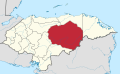
| Country |  Honduras Honduras |
| Department | Olancho |
| Villages | 13 |
| Government | |
| Area | |
| • Total | 533.7 km2 (206.1 sq mi) |
| Population (2015) | |
| • Total | 19,690 |
| • Density | 37/km2 (96/sq mi) |
| Climate | Aw |
San Francisco de la Paz (Spanish pronunciation: [saɱ fɾanˈsisko ðe la ˈpas]) is a municipality in the centre of the Honduran department of Olancho.
First known as San Francisco Zapote, the name was changed by bishop Francisco de Paula Campoy y Pérez, for the actual name. The town is located in a small valley formed by the hills "La Cruz" (The Cross) and "Cayo Blanco" (White Cay) in the North and the hill "El Ocotal" in the South.
The extension of San Francisco de la Paz is 540.2 km².
Demographics
At the time of the 2013 Honduras census, San Francisco de la Paz municipality had a population of 19,216. Of these, 98.64% were Mestizo, 0.51% White, 0.50% Indigenous, 0.23% Black or Afro-Honduran and 0.12% others.[1]
References
- ^ Instituto Nacional de Estadística (INE), bases de datos en línea
- v
- t
- e
Olancho Department
Capital: Juticalpa
- Campamento
- Catacamas
- Concordia
- Dulce Nombre de Culmí
- El Rosario
- Esquipulas del Norte
- Gualaco
- Guarizama
- Guata
- Guayape
- Jano
- Juticalpa
- La Unión
- Mangulile
- Manto
- Patuca
- Salamá
- San Esteban
- San Francisco de Becerra
- San Francisco de la Paz
- Santa Maria del Real
- Silca
- Yocón
 | This Honduras location article is a stub. You can help Wikipedia by expanding it. |
- v
- t
- e


 San_Francisco_de_la_Paz