Uchkoʻprik District
District in Fergana Region, Uzbekistan
Uchkoʻprik District | |
|---|---|
District | |
| Uchkoʻprik tumani | |
 | |
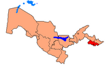
| Country | Uzbekistan |
| Region | Fergana Region |
| Capital | Uchkoʻprik |
| Established | 1926 |
| Area | |
| • Total | 280 km2 (110 sq mi) |
| Population (2022) | |
| • Total | 237,300 |
| • Density | 850/km2 (2,200/sq mi) |
| Time zone | UTC+5 (UZT) |
Uchkoʻprik District (Uzbek: Uchkoʻprik tumani) is a district of Fergana Region in Uzbekistan. The capital lies at the town Uchkoʻprik.[1] It has an area of 280 km2 (110 sq mi)[2] and it had 237,300 inhabitants in 2022.[3] The district consists of 11 urban-type settlements (Uchkoʻprik, Begobod, Gʻijdan, (Katta Qashqar), Qumariqobod, Bogʻiboʻston, Mirzaxoʻja, Palaxon, Sobirjon, Turgʻoq, Yangiqishloq) and 9 rural communities.[1]
References
- ^ a b "Classification system of territorial units of the Republic of Uzbekistan" (in Uzbek and Russian). The State Committee of the Republic of Uzbekistan on statistics. July 2020.
- ^ "O'zbekiston Respublikasining ma'muriy-hududiy bo'linishi" [Administrative-territorial division of the Republic of Uzbekistan] (PDF) (in Uzbek). Fergana regional department of statistics.
- ^ "Hududlar bo'yicha shahar va qishloq aholisi soni" [Urban and rural population by district] (PDF) (in Uzbek). Fergana regional department of statistics.
- v
- t
- e
Fergana Region
Capital: Fergana
40°30′40″N 71°01′33″E / 40.5111°N 71.0258°E / 40.5111; 71.0258
 | This Uzbekistan location article is a stub. You can help Wikipedia by expanding it. |
- v
- t
- e


 Uchkoʻprik_District