Hedrehely
Village in Southern Transdanubia, Hungary
Hedrehely Hadralj (in Croatian) | |
|---|---|
Village | |
 Reformed Church of Hedrehely | |
 Coat of arms | |
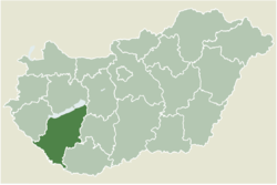 Location of Somogy county in Hungary | |
| 46°12′06″N 17°38′56″E / 46.20167°N 17.64902°E / 46.20167; 17.64902 | |
| Country |  Hungary Hungary |
| Region | Southern Transdanubia |
| County | Somogy |
| District | Kaposvár |
| RC Diocese | Kaposvár |
| Area | |
| • Total | 25.51 km2 (9.85 sq mi) |
| Population (2017) | |
| • Total | 375[1] |
| Demonym | hedrehelyi |
| Time zone | UTC+1 (CET) |
| • Summer (DST) | UTC+2 (CEST) |
| Postal code | 7533 |
| Area code | (+36) 82 |
| NUTS 3 code | HU232 |
| MP | László Szászfalvi (KDNP) |
Hedrehely (Croatian: Hadralj) is a village in Somogy county, Hungary.
History
According to László Szita the settlement was completely Hungarian in the 18th century.[2]
External links
- Street map (Hungarian)
References
- v
- t
- e
- Kaposvár (district seat)

- Alsóbogát
- Baté
- Bodrog
- Bárdudvarnok
- Büssü
- Bőszénfa
- Cserénfa
- Csoma
- Csombárd
- Csököly
- Ecseny
- Edde
- Felsőmocsolád
- Fonó
- Gadács
- Gige
- Gálosfa
- Gölle
- Hajmás
- Hedrehely
- Hencse
- Hetes
- Juta
- Jákó
- Kaposfő
- Kaposgyarmat
- Kaposhomok
- Kaposkeresztúr
- Kaposmérő
- Kaposszerdahely
- Kaposújlak
- Kazsok
- Kercseliget
- Kisasszond
- Kisgyalán
- Kiskorpád
- Kőkút
- Magyaratád
- Magyaregres
- Mernye
- Mezőcsokonya
- Mike
- Mosdós
- Nagyberki
- Orci
- Osztopán
- Patalom
- Patca
- Polány
- Pálmajor
- Rinyakovácsi
- Ráksi
- Simonfa
- Somodor
- Somogyaszaló
- Somogyfajsz
- Somogygeszti
- Somogyjád
- Somogyszil
- Somogysárd
- Szabadi
- Szenna
- Szentbalázs
- Szentgáloskér
- Szilvásszentmárton
- Sántos
- Taszár
- Újvárfalva
- Visnye
- Várda
- Zimány
- Zselickisfalud
- Zselickislak
- Zselicszentpál


 | This Somogy county location article is a stub. You can help Wikipedia by expanding it. |
- v
- t
- e


 Hedrehely