Somogyzsitfa
Village in Southern Transdanubia, Hungary
Somogyzsitfa Somogyfehéregyháza and Felsőzsitva (until 1950) | |
|---|---|
Village | |
 Chapel of Szőcsénypuszta | |
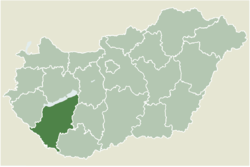 Location of Somogy county in Hungary | |
| 46°32′54″N 17°18′02″E / 46.5483°N 17.30046°E / 46.5483; 17.30046 | |
| Country |  Hungary Hungary |
| Region | Southern Transdanubia |
| County | Somogy |
| District | Marcali |
| RC Diocese | Kaposvár |
| Area | |
| • Total | 27.22 km2 (10.51 sq mi) |
| Population (2017) | |
| • Total | 583[1] |
| Demonym(s) | zsitfai, somogyzsitfai |
| Time zone | UTC+1 (CET) |
| • Summer (DST) | UTC+2 (CEST) |
| Postal code | 8734 |
| Area code | (+36) 85 |
| NUTS 3 code | HU232 |
| MP | József Attila Móring (KDNP) |
| Website | Somogyzsitva Online |
Somogyzsitfa (until 1950 as Somogyfehéregyháza and Felsőzsitva) is a village in Somogy county, Hungary. It consists of the two former villages of Somogyfehéregyháza and Felsőzsitva.
The settlement is part of the Balatonboglár wine region.[2]
Etymology
Somogyfehéregyháza (English: Somogy white house) got its name after its whitewashed buildings or church during the Middle Ages. The name of Felsőzsitva consists of the Hungarian felső (English: upper) and the South Slavic zsitva (Hungarian: gabona, English: grain).[3]
External links
- Street map (Hungarian)
References
- v
- t
- e
- Marcali (district seat)

- Balatonberény
- Balatonkeresztúr
- Balatonmáriafürdő
- Balatonszentgyörgy
- Balatonújlak
- Böhönye
- Csákány
- Csömend
- Főnyed
- Gadány
- Hollád
- Hosszúvíz
- Kelevíz
- Kéthely
- Libickozma
- Mesztegnyő
- Nagyszakácsi
- Nemesdéd
- Nemeskisfalud
- Nemesvid
- Nikla
- Pusztakovácsi
- Sávoly
- Somogysámson
- Somogysimonyi
- Somogyszentpál
- Somogyzsitfa
- Szegerdő
- Szenyér
- Szőkedencs
- Tapsony
- Táska
- Tikos
- Varászló
- Vése
- Vörs


 | This Somogy county location article is a stub. You can help Wikipedia by expanding it. |
- v
- t
- e


 Somogyzsitfa